|
|
|
0 members (),
3,417
guests, and
27
robots. |
|
Key:
Admin,
Global Mod,
Mod
|
|
S |
M |
T |
W |
T |
F |
S |
|
1
|
2
|
3
|
4
|
5
|
6
|
7
|
|
8
|
9
|
10
|
11
|
12
|
13
|
14
|
|
15
|
16
|
17
|
18
|
19
|
20
|
21
|
|
22
|
23
|
24
|
25
|
26
|
27
|
28
|
|
29
|
30
|
|
|
|
|
|
|
There are no members with birthdays on this day. |
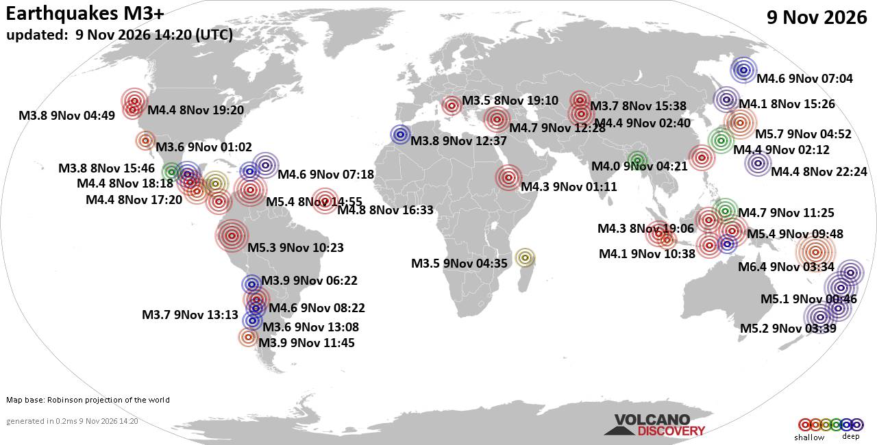
World Earthquake Report for Monday, 9 November 2026
• Strong mag. 5.5 earthquake - Colombia: Caribbean Sea on Monday, Nov 9, 2026...
• M 2.0 - 29 km SE of Whittier, Alaska
• M 2.1 - 13 km E of South Lead Hill, Arkansas
• M 2.6 - 15 km NNE of Milford, Utah
• M 2.1 - 14 km NE of Milford, Utah
|
|
|
Joined: Feb 2001
Posts: 800,656
Launch Director
|
|
Launch Director
Joined: Feb 2001
Posts: 800,656 |
SPC Nov 9, 2026 1300 UTC Day 1 Convective OutlookSPC 1300Z Day 1 Outlook 
Day 1 Convective Outlook
NWS Storm Prediction Center Norman OK
0640 AM CST Mon Nov 09 2026

Valid 091300Z - 101200Z

...NO SEVERE THUNDERSTORM AREAS FORECAST...

...SUMMARY...
Organized severe thunderstorms are not forecast through tonight.

...Synopsis and Discussion...
Generally elevated thunderstorms are ongoing this morning across
parts of south TX to the north of a weak inverted surface trough.
This convection is being aided by large-scale ascent and modest
low-level warm advection occurring ahead of a weak upper trough over
west TX/northern Mexico. Weak MUCAPE and poor lapse rates aloft are
expected to limit the severe threat this morning (reference the 12Z
observed CRP/BRO soundings). Also, the potential for surface-based
thunderstorms over land appears lower than yesterday, and any
stronger thunderstorms should tend to focus offshore through the
morning into early afternoon.

Another fast-moving upper trough is forecast to overspread the
Pacific Northwest this afternoon through tonight. Surface dewpoints
in the upper 40s to low 50s and filtered daytime heating should
allow MUCAPE up to 100-300 J/kg to develop along/ahead of a
low-topped band of convection expected to move quickly eastward
across coastal WA/OR this afternoon. Occasional lightning flashes
may occur with this activity, as mid-level temperatures will be
fairly cold. While strong low/mid-level winds veering with height
appear conditionally favorable for organized updrafts, the meager
instability should tend to limit the risk for severe gusts.

..Gleason/Wendt.. 11/09/2026
Read morehttps://www.spc.noaa.gov/products/outlook/day1otlk_1300.html
|
|



CMS The Best Conveyancing solicitors conveyancing quotes throughout the UK
For any webhosting enquiries please email webmaster@aus-city.com
|
|
Forums60
Topics918,443
Posts953,240
Members2,960
| |
Most Online102,106
Jul 10th, 2026
|
|
|
|
|

|









































