|
|
|
0 members (),
3,669
guests, and
19
robots. |
|
Key:
Admin,
Global Mod,
Mod
|
|
S |
M |
T |
W |
T |
F |
S |
|
1
|
2
|
3
|
4
|
5
|
6
|
7
|
|
8
|
9
|
10
|
11
|
12
|
13
|
14
|
|
15
|
16
|
17
|
18
|
19
|
20
|
21
|
|
22
|
23
|
24
|
25
|
26
|
27
|
28
|
|
29
|
30
|
|
|
|
|
|
|
There are no members with birthdays on this day. |
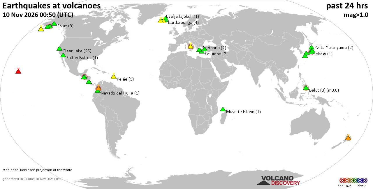
Volcano earthquake report for Tuesday, 10 November 2026
• M -0.6 - 63 km ENE of Pedro Bay, Alaska
• M 0.6 - 47 km ENE of Adak, Alaska
• M 2.3 - 54 km ENE of Susitna North, Alaska
• M 1.4 - 60 km WNW of Nikiski, Alaska
• M 1.1 - 109 km S of McCarthy, Alaska
|
|
|
Joined: Feb 2001
Posts: 800,656
Launch Director
|
|
Launch Director
Joined: Feb 2001
Posts: 800,656 |
SPC Nov 10, 2026 0100 UTC Day 1 Convective OutlookSPC 0100Z Day 1 Outlook 
Day 1 Convective Outlook
NWS Storm Prediction Center Norman OK
0635 PM CST Mon Nov 09 2026

Valid 100100Z - 101200Z

...NO SEVERE THUNDERSTORM AREAS FORECAST...

...SUMMARY...
Severe thunderstorms are unlikely through tonight.

...Pacific Northwest...

Within the southern fringe of a broader precipitation band preceding
a vigorous short-wave trough, embedded convective elements
sufficiently deep for lightning generation have recently moved onto
the OR coast. Modification of the 00Z UIL sounding for a slightly
warmer and more moist PBL farther to the south yields a narrow CAPE
profile extending upwards into the -10 to -20 C layer with MUCAPE of
a few hundred J/kg, which is consistent with the lightning
observations. A similar thermodynamic environment is expected to
spread inland this evening into tonight, supporting the continuation
of sporadic lightning occurrences. Turbulent downward mixing of
stronger flow aloft may yield a few strong wind gusts; however,
severe weather is not expected.


...Portions of Deep South Texas to the middle Texas Coast....

As of 00Z, the most vigorous convection was located offshore to the
southeast of Brownsville, within a zone of stronger surface-based
buoyancy. Farther north along the lower to middle TX Coast, a modest
low-level warm-advection regime is expected to persist overnight, in
which a few elevated thunderstorms will remain possible amidst a
marginally unstable environment (per 00Z BRO/CRP soundings).

..Mead.. 11/10/2026
Read morehttps://www.spc.noaa.gov/products/outlook/day1otlk_0100.html
|
|



CMS The Best Conveyancing solicitors conveyancing quotes throughout the UK
For any webhosting enquiries please email webmaster@aus-city.com
|
|
Forums60
Topics919,598
Posts954,395
Members2,960
| |
Most Online102,106
Jul 10th, 2026
|
|
|
|
|

|









































