|
|
|
0 members (),
3,839
guests, and
23
robots. |
|
Key:
Admin,
Global Mod,
Mod
|
|
S |
M |
T |
W |
T |
F |
S |
|
1
|
2
|
3
|
4
|
5
|
6
|
7
|
|
8
|
9
|
10
|
11
|
12
|
13
|
14
|
|
15
|
16
|
17
|
18
|
19
|
20
|
21
|
|
22
|
23
|
24
|
25
|
26
|
27
|
28
|
|
29
|
30
|
|
|
|
|
|
|
There are no members with birthdays on this day. |
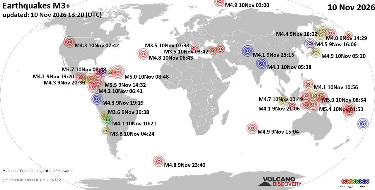
World Earthquake Report for Tuesday, 10 November 2026
• M 0.6 - 10 km S of Midland, Texas
• M 1.6 - 8 km W of Upper Lake, CA
• M 4.3 - 19 km ESE of Joseph, Oregon
• M 1.3 - 17 km SW of Jal, New Mexico
• M 1.9 - 3 km S of Pāhala, Hawaii
|
|
|
Joined: Feb 2001
Posts: 800,656
Launch Director
|
|
Launch Director
Joined: Feb 2001
Posts: 800,656 |
SPC Nov 10, 2026 1300 UTC Day 1 Convective OutlookSPC 1300Z Day 1 Outlook 
Day 1 Convective Outlook
NWS Storm Prediction Center Norman OK
0636 AM CST Tue Nov 10 2026

Valid 101300Z - 111200Z

...NO SEVERE THUNDERSTORM AREAS FORECAST...

...SUMMARY...
Organized severe thunderstorms are not forecast through tonight.

...Synopsis and Discussion...
Elevated thunderstorms may persist for much of the period across
coastal TX/LA as a weak mid-level shortwave trough evolves eastward
across the southern Plains into the lower MS Valley. With MUCAPE
forecast to generally remain less than 1000 J/kg amid modest lapse
rates aloft, any hail with stronger cells that develop over land
should remain sub-severe. Occasional lightning flashes may also
occur with low-topped convection that will move quickly
east-northeastward across parts of coastal WA today in tandem with
another mid-level shortwave trough, but very weak instability will
limit the severe threat with this activity.

..Gleason/Wendt.. 11/10/2026
Read morehttps://www.spc.noaa.gov/products/outlook/day1otlk_1300.html
|
|



CMS The Best Conveyancing solicitors conveyancing quotes throughout the UK
For any webhosting enquiries please email webmaster@aus-city.com
|
|
Forums60
Topics920,231
Posts955,028
Members2,960
| |
Most Online102,106
Jul 10th, 2026
|
|
|
|
|

|









































