|
|
|
0 members (),
3,332
guests, and
26
robots. |
|
Key:
Admin,
Global Mod,
Mod
|
|
S |
M |
T |
W |
T |
F |
S |
|
1
|
2
|
3
|
4
|
5
|
6
|
7
|
|
8
|
9
|
10
|
11
|
12
|
13
|
14
|
|
15
|
16
|
17
|
18
|
19
|
20
|
21
|
|
22
|
23
|
24
|
25
|
26
|
27
|
28
|
|
29
|
30
|
|
|
|
|
|
|
There are no members with birthdays on this day. |
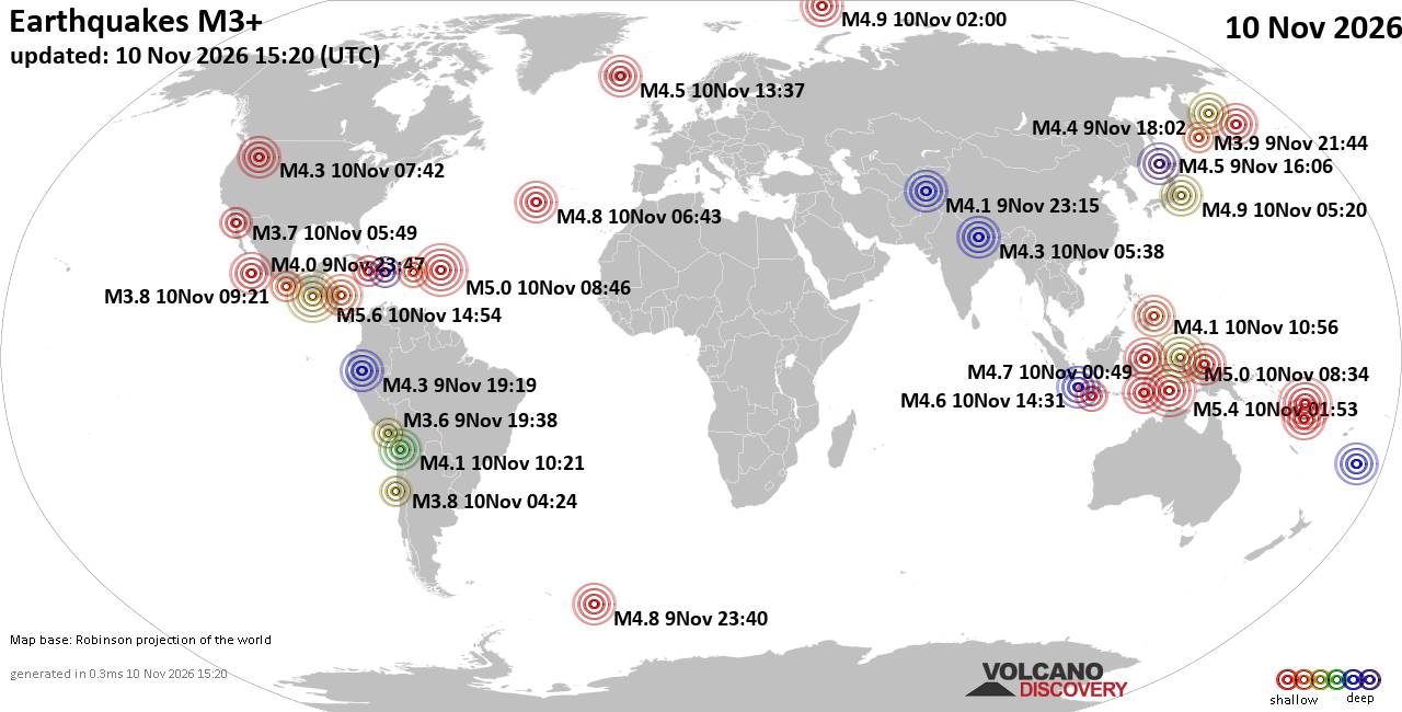
World Earthquake Report for Tuesday, 10 November 2026
• M 4.3 - 19 km ESE of Joseph, Oregon
• M 1.6 - 12 km N of Meadow Lakes, Alaska
• M 4.3 - 123 km N of Metinaro, Timor Leste
• M 1.0 - 15 km NNW of Borrego Springs, CA
• M 2.5 - 49 km S of Nikolski, Alaska
• M 1.7 - 12 km NE of Pāhala, Hawaii
|
|
|
Joined: Feb 2001
Posts: 800,656
Launch Director
|
|
Launch Director
Joined: Feb 2001
Posts: 800,656 |
SPC Nov 10, 2026 1730 UTC Day 2 Convective OutlookSPC 1730Z Day 2 Outlook 
Day 2 Convective Outlook
NWS Storm Prediction Center Norman OK
1116 AM CST Tue Nov 10 2026

Valid 111200Z - 121200Z

...THERE IS A MARGINAL RISK OF SEVERE THUNDERSTORMS ACROSS PORTIONS
OF THE LOWER OHIO AND WESTERN TENNESSEE VALLEYS...

...SUMMARY...
Thunderstorms with isolated severe wind gusts and perhaps a tornado
or two will be possible on Wednesday across parts of the lower Ohio
and western Tennessee Valleys.

... Synopsis ...

The midlevel flow is expected to amplify on Wednesday as a shortwave
trough digs southeast across the Mississippi Valley. This digging
trough will help carve out an eastern US long-wave trough at the
same time as a ridge builds across the western US.

At the surface a weak surface low will move east from Illinois
toward eastern Ohio. To the southwest of this low a surface cold
front will push south and east. Low-level moisture will increase
slightly ahead of the advancing cold front.


... Lower Ohio and western Tennessee Valleys ...

Ahead on the approaching cold front, diurnal heating will combine
with increasing surface moisture to result in modest destabilization
(REFS indicating around 40-60 percent chance MUCAPE at least 500
J/kg, but less than 10 percent change of exceeding 1000 J/kg) during
the late afternoon across the area. Scattered thunderstorms will
likely develop by early evening as the cold front interacts with the
axis of greater instability. Strong mid-level wind fields may
support a few strong, perhaps damaging, wind gusts. Additionally,
forecast low-level wind fields indicate modest turning with height
across the region, which may support a brief window for a tornado or
two. This marginal tornado threat would be highly conditional on the
quality of the low-level moisture and degree of instability that is
realized.

..Marsh.. 11/10/2026
Read morehttps://www.spc.noaa.gov/products/outlook/day2otlk_1730.html
|
|



CMS The Best Conveyancing solicitors conveyancing quotes throughout the UK
For any webhosting enquiries please email webmaster@aus-city.com
|
|
Forums60
Topics920,478
Posts955,275
Members2,960
| |
Most Online102,106
Jul 10th, 2026
|
|
|
|
|

|









































