|
|
|
0 members (),
3,324
guests, and
18
robots. |
|
Key:
Admin,
Global Mod,
Mod
|
|
S |
M |
T |
W |
T |
F |
S |
|
1
|
2
|
3
|
4
|
5
|
6
|
7
|
|
8
|
9
|
10
|
11
|
12
|
13
|
14
|
|
15
|
16
|
17
|
18
|
19
|
20
|
21
|
|
22
|
23
|
24
|
25
|
26
|
27
|
28
|
|
29
|
30
|
|
|
|
|
|
|
There are no members with birthdays on this day. |
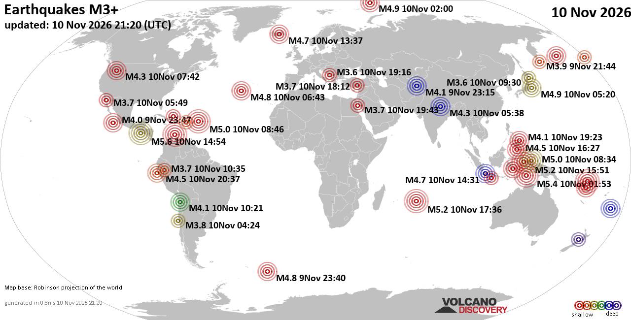
World Earthquake Report for Tuesday, 10 November 2026
• M -0.3 - 76 km NE of Nikolski, Alaska
• M 1.1 - 9 km S of Lake Henshaw, CA
• M 1.7 - 0 km SW of Pāhala, Hawaii
• M 1.2 - 26 km WSW of Westley, CA
• M 1.2 - 10 km W of Forsan, Texas
|
|
|
Joined: Feb 2001
Posts: 800,656
Launch Director
|
|
Launch Director
Joined: Feb 2001
Posts: 800,656 |
SPC Nov 10, 2026 1930 UTC Day 3 Severe Thunderstorm OutlookSPC 1930Z Day 3 Outlook 
Day 3 Convective Outlook
NWS Storm Prediction Center Norman OK
0113 PM CST Tue Nov 10 2026

Valid 121200Z - 131200Z

...NO SEVERE THUNDERSTORM AREAS FORECAST...

...SUMMARY...
No severe thunderstorms are forecast across the U.S. Thursday and
Thursday night.

... Synopsis ...

On Thursday the evolving eastern US longwave trough will continue to
be reinforced as a series of midlevel shortwave troughs move through
the broader flow. One such trough will overspread the Mid-Atlantic
region during the day and into the overnight on Thursday.
Large-scale ascent associated with this trough should allow for
showers and perhaps a few thunderstorms from the Mid-Atlantic
northward along the far southern New England coast.

Despite strengthening low-level wind fields, scant low-level
moisture and cool/cold thermal profiles should limit thunderstorm
development. One area of potential will be along the Mid-Atlantic
where slightly better low-level moisture will reside and along the
coastal region of southern New England where low-level thermal and
moisture profiles will be modulated by the warmer waters of the
Atlantic. Instability should remain too weak to support severe
thunderstorms.

Additional thunderstorms will be possible across far south Florida
where modest instability will reside ahead of an advancing cold
front. Tropospheric winds across this area will strengthen in
response to the deepening/strengthening eastern US longwave trough.
The strengthening wind field may support some potential for a strong
or severe thunderstorm across far south Florida before the surface
front pushes south of the area. However, at this time concerns with
the timing of the frontal passage and when the kinematic fields
respond to the upper trough result in confidence of severe being too
low to warrant unconditional probabilities at this time.

..Marsh.. 11/10/2026
Read morehttps://www.spc.noaa.gov/products/outlook/day3otlk_1930.html
|
|



CMS The Best Conveyancing solicitors conveyancing quotes throughout the UK
For any webhosting enquiries please email webmaster@aus-city.com
|
|
Forums60
Topics920,920
Posts955,717
Members2,960
| |
Most Online102,106
Jul 10th, 2026
|
|
|
|
|

|









































