|
0 members (),
3,839
guests, and
24
robots. |
|
Key:
Admin,
Global Mod,
Mod
|
|
S |
M |
T |
W |
T |
F |
S |
|
1
|
2
|
3
|
4
|
5
|
6
|
7
|
|
8
|
9
|
10
|
11
|
12
|
13
|
14
|
|
15
|
16
|
17
|
18
|
19
|
20
|
21
|
|
22
|
23
|
24
|
25
|
26
|
27
|
28
|
|
29
|
30
|
|
|
|
|
|
|
There are no members with birthdays on this day. |
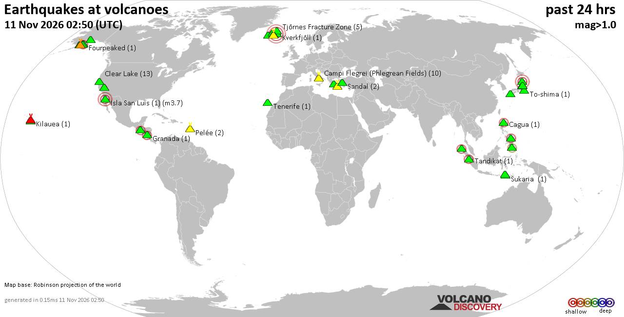
Volcano earthquake report for Wednesday, 11 November 2026
• Moderate, deep magnitude-5.4 earthquake reported 28 km southwest of Calama,...
• M 0.6 - 14 km ENE of Ridgecrest, CA
• Moderate magnitude 4.7 earthquake 89 km west of Saumlaki, Indonesia
• M 0.8 - 65 km WNW of Tyonek, Alaska
• Strong mag. 5.4 earthquake - Provincia de Tocopilla, 28 km west of Calama, ...
|
|
|
Joined: Feb 2001
Posts: 800,656
Launch Director
|
|
Launch Director
Joined: Feb 2001
Posts: 800,656 |
SPC Day 2 Fire Weather OutlookSPC Day 2 Fire Weather Outlook 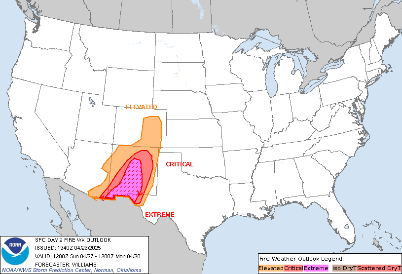
Day 2 Fire Weather Outlook
NWS Storm Prediction Center Norman OK
1136 PM CST Tue Nov 10 2026

Valid 121200Z - 131200Z

...NO CRITICAL AREAS...

...Synopsis...
The upper-level pattern over the CONUS will remain amplified on Day
2/Thursday with a deep trough over the eastern US, ridging over the
Intermountain West, and troughing moving onto West Coast. A cold
front will sweep southeast through the Southeast as a surface
cyclone moves off the Mid-Atlantic coast.

Dry and breezy post-frontal conditions will develop across portions
of the Southeast, and locally elevated conditions are likely from
the Lower Mississippi Valley into portions of the Carolinas.
Northwest-west sustained winds of 10-18 mph amid minimum RH of
25-40% are forecast from the Lower Mississippi Valley extending east
through the Deep South into the Carolinas. Forecast burning index
values may exceed the 80th percentile and approach the 90th
percentile in portions of this area. If the forecast continues to
trend towards little to no pre-frontal rainfall and better alignment
of dry/breezy conditions with modestly receptive fuels, an elevated
area may be warranted. Additionally, this is the type of scenario
where forecast guidance can under predict winds and over predict RH.

..Nauslar.. 11/11/2026

...Please see www.spc.noaa.gov/fire for graphic product...
Read morehttps://www.spc.noaa.gov/products/fire_wx/fwdy2.html
|
|



CMS The Best Conveyancing solicitors conveyancing quotes throughout the UK
For any webhosting enquiries please email webmaster@aus-city.com
|
|
Forums60
Topics921,923
Posts956,720
Members2,960
| |
Most Online102,106
Jul 10th, 2026
|
|
|









































