|
|
|
1 members (Alisa),
3,724
guests, and
24
robots. |
|
Key:
Admin,
Global Mod,
Mod
|
|
S |
M |
T |
W |
T |
F |
S |
|
1
|
2
|
3
|
4
|
5
|
6
|
7
|
|
8
|
9
|
10
|
11
|
12
|
13
|
14
|
|
15
|
16
|
17
|
18
|
19
|
20
|
21
|
|
22
|
23
|
24
|
25
|
26
|
27
|
28
|
|
29
|
30
|
|
|
|
|
|
|
There are no members with birthdays on this day. |
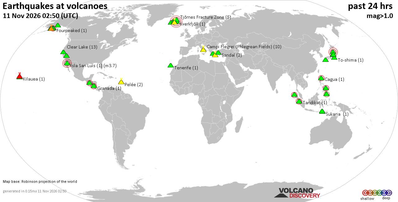
Volcano earthquake report for Wednesday, 11 November 2026
• M 2.5 - 39 km SW of Karluk, Alaska
• M 1.5 - 12 km ESE of Mammoth Lakes, CA
• M 2.2 - 88 km SE of Akutan, Alaska
• M 1.8 - 14 km E of Pearsall, Texas
• M 2.1 - 28 km SSW of Larsen Bay, Alaska
• M 1.6 - 64 km NW of Tatitlek, Alaska
|
|
|
Joined: Feb 2001
Posts: 800,656
Launch Director
|
|
Launch Director
Joined: Feb 2001
Posts: 800,656 |
SPC Nov 11, 2026 1930 UTC Day 3 Severe Thunderstorm OutlookSPC 1930Z Day 3 Outlook 
Day 3 Convective Outlook
NWS Storm Prediction Center Norman OK
0123 PM CST Wed Nov 11 2026

Valid 131200Z - 141200Z

...NO SEVERE THUNDERSTORM AREAS FORECAST...

...SUMMARY...
Severe thunderstorms are not expected Friday into early Saturday
morning.

...Synopsis...
A broad upper trough will prevail over the eastern CONUS while a
broad, negatively tilted upper trough deepens west of the Rockies on
Friday. Surface high pressure will reinforce a stable airmass east
of the Rockies, limiting thunderstorm development over most of the
CONUS. A few lightning flashes are possible across portions of the
Desert Southwest into the southern High Plains in association with a
warm-air advection regime preceding the upper trough. A couple of
lightning flashes may also occur along the Pacific coastline closer
to the upper trough in association with a plume of cooler
temperatures aloft.

..Squitieri.. 11/11/2026
Read morehttps://www.spc.noaa.gov/products/outlook/day3otlk_1930.html
|
|



CMS The Best Conveyancing solicitors conveyancing quotes throughout the UK
For any webhosting enquiries please email webmaster@aus-city.com
|
|
Forums60
Topics922,651
Posts957,448
Members2,960
| |
Most Online102,106
Jul 10th, 2026
|
|
|
|
|

|









































