|
|
|
0 members (),
3,448
guests, and
25
robots. |
|
Key:
Admin,
Global Mod,
Mod
|
|
S |
M |
T |
W |
T |
F |
S |
|
1
|
2
|
3
|
4
|
5
|
6
|
7
|
|
8
|
9
|
10
|
11
|
12
|
13
|
14
|
|
15
|
16
|
17
|
18
|
19
|
20
|
21
|
|
22
|
23
|
24
|
25
|
26
|
27
|
28
|
|
29
|
30
|
|
|
|
|
|
|
There are no members with birthdays on this day. |
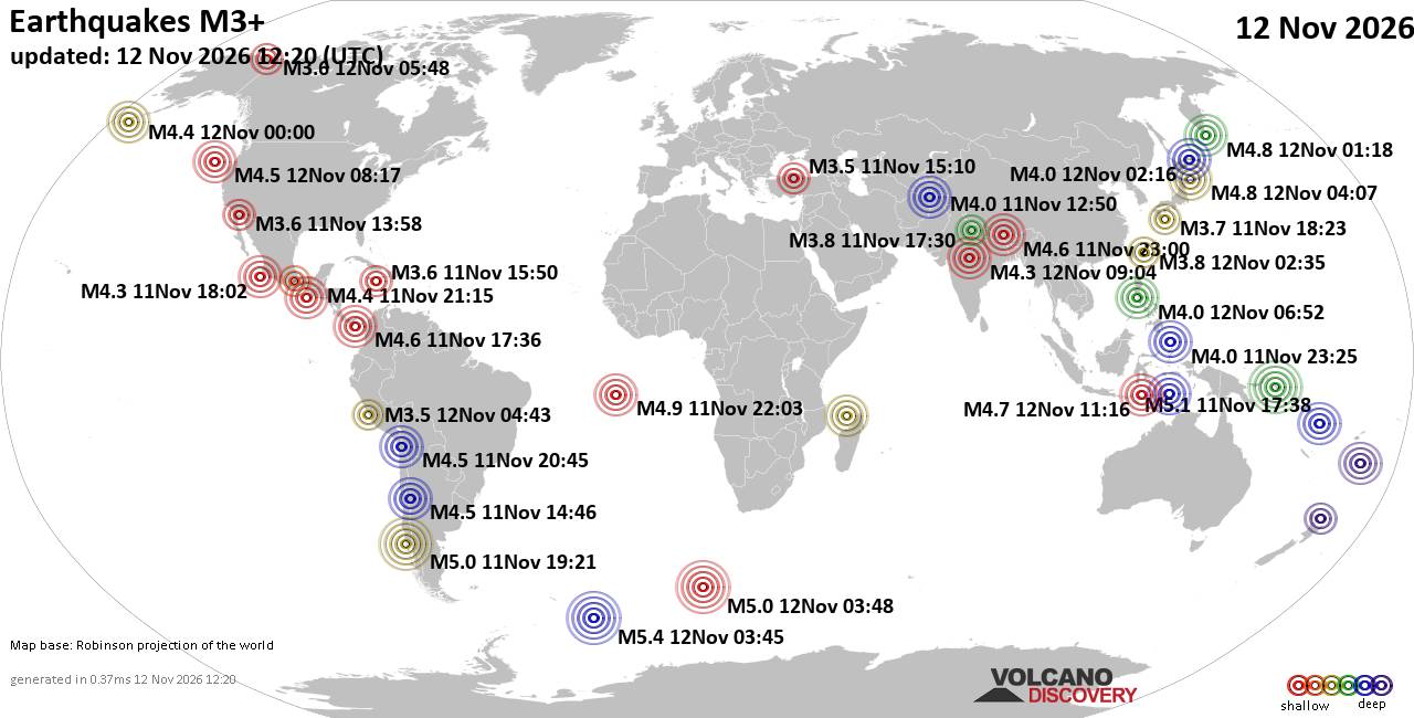
World Earthquake Report for Thursday, 12 November 2026
• M 2.7 - 140 km SSE of False Pass, Alaska
• M 1.6 - 3 km N of Mira Loma, CA
• M 1.0 - 10 km NW of Pine Valley, CA
• M 1.5 - 14 km N of Warner Springs, CA
• M 0.9 - 4 km SW of Anza, CA
• M 6.0 - 184 km NW of Port-Olry, Vanuatu
|
|
|
Joined: Feb 2001
Posts: 800,656
Launch Director
|
|
Launch Director
Joined: Feb 2001
Posts: 800,656 |
SPC Nov 12, 2026 1300 UTC Day 1 Convective OutlookSPC 1300Z Day 1 Outlook 
Day 1 Convective Outlook
NWS Storm Prediction Center Norman OK
0648 AM CST Thu Nov 12 2026

Valid 121300Z - 131200Z

...THERE IS A MARGINAL RISK OF SEVERE THUNDERSTORMS ACROSS PARTS OF
THE COASTAL MID-ATLANTIC...

...SUMMARY...
Strong to severe thunderstorms capable of producing isolated severe
hail, damaging winds, and perhaps a tornado may impact parts of the
coastal Mid-Atlantic this afternoon.

...Coastal Mid-Atlantic...
Within large-scale upper troughing encompassing much of the
central/eastern CONUS, an embedded mid-level shortwave trough over
the OH Valley will move eastward across the Mid-Atlantic today. A
related weak surface low is also expected to develop eastward across
MD/DE/southern NJ this afternoon. While low-level moisture ahead of
these features should remain modest over land (generally low to mid
50s surface dewpoints), an effective warm front is forecast to
extend from the surface low across eastern PA into NJ. Thunderstorms
may initiate along/near this boundary by 16-18Z, with weak
instability expected to develop as filtered daytime heating occurs.
Stronger flow associated with a mid-level jet will tend to remain
displaced to the south of the coastal Mid-Atlantic through the day,
but veering winds with height through mid-levels will still support
around 25-40 kt of deep-layer shear.

Given cold mid-level temperatures (around -20 to -22 C at 500 mb)
and modestly steepened lapse rates aloft, any of the stronger cells
that develop could produce severe hail. Isolated damaging winds also
appear possible as this convection spreads from eastern PA into NJ
and vicinity before moving offshore. Low-level winds and related
shear should remain fairly modest, but a somewhat more favorable
zone for a tornado may exist if a persistent supercell can interact
with/cross the surface warm front this afternoon across eastern PA
into NJ. The northern extent of the severe risk will likely remain
constrained by the warm front, and it still appears likely that
appreciable severe risk will tend to remain offshore/south of Long
Island and southern New England.

..Gleason/Wendt.. 11/12/2026
Read morehttps://www.spc.noaa.gov/products/outlook/day1otlk_1300.html
|
|



CMS The Best Conveyancing solicitors conveyancing quotes throughout the UK
For any webhosting enquiries please email webmaster@aus-city.com
|
|
Forums60
Topics923,878
Posts958,675
Members2,960
| |
Most Online102,106
Jul 10th, 2026
|
|
|
|
|

|









































