|
1 members (Alisa),
2,400
guests, and
23
robots. |
|
Key:
Admin,
Global Mod,
Mod
|
|
S |
M |
T |
W |
T |
F |
S |
|
1
|
2
|
3
|
4
|
5
|
6
|
7
|
|
8
|
9
|
10
|
11
|
12
|
13
|
14
|
|
15
|
16
|
17
|
18
|
19
|
20
|
21
|
|
22
|
23
|
24
|
25
|
26
|
27
|
28
|
|
29
|
30
|
|
|
|
|
|
|
There are no members with birthdays on this day. |
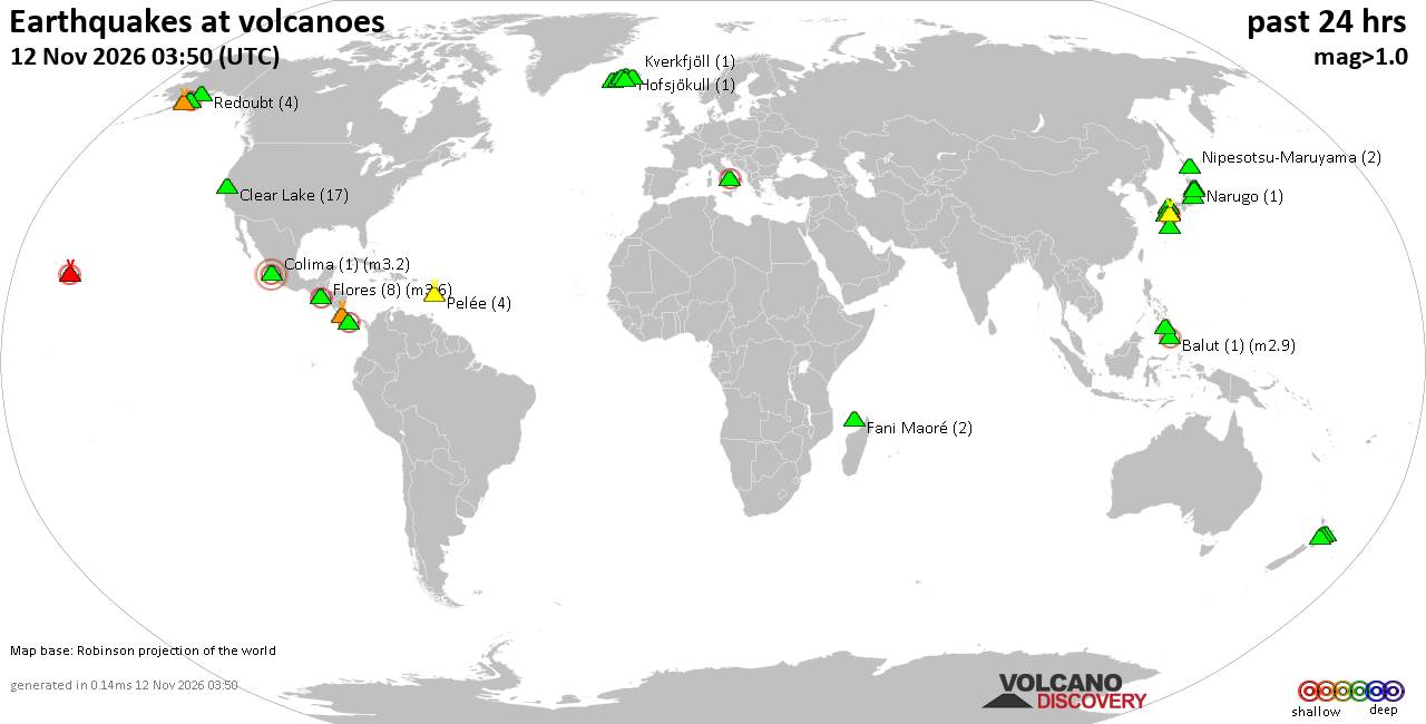
Volcano earthquake report for Thursday, 12 November 2026
• M 1.8 - 15 km E of Pearsall, Texas
• M 1.8 - 15 km E of Pearsall, Texas
• M 1.5 - 5 km WNW of San Francisco Zoo, CA
• M 1.5 - 5 km WNW of San Francisco Zoo, CA
• M 2.1 - 63 km SE of Denali National Park, Alaska
• M 2.1 - 63 km SE of Denali National Park, Alaska
|
|
|
Joined: Feb 2001
Posts: 800,656
Launch Director
|
|
Launch Director
Joined: Feb 2001
Posts: 800,656 |
SPC MD 2452MD 2452 CONCERNING TORNADO WATCH 705... FOR FAR SOUTHEAST PENNSYLVANIA INTO NEW JERSEY 
Mesoscale Discussion 2452
NWS Storm Prediction Center Norman OK
0154 PM CST Thu Nov 12 2026

Areas affected...far southeast Pennsylvania into New Jersey

Concerning...Tornado Watch 705...

Valid 121954Z - 122200Z

The severe weather threat for Tornado Watch 705 continues.

SUMMARY...The threat of hail and perhaps a tornado will persist as
storms move east across the Delaware River.

DISCUSSION...A line of storms with a tail-end supercell is expected
to persist into central NJ where the air mass remains sufficiently
unstable. Temperatures have warmed, with some mixing of the
dewpoints into lower 50s F, down from mid 50s F earlier. Low-level
shear per TPHL VWP shows around 100 m2/s2 0-1 SRH, also down from
earlier today. Cold temperatures aloft will continue to support
hail. Tornado potential is more conditional given current trends,
but storms intersecting the east-west front over northern NJ may
experience some enhanced rotation potential there. VWPs to the south
from KDOX and KLWX show gradually veering of the low-level winds,
with additional storm formation south of the existing activity
becoming less likely as drying moves in the the west.

..Jewell.. 11/12/2026

...Please see www.spc.noaa.gov for graphic product...

ATTN...WFO...OKX...PHI...

LAT...LON   39787540 40207528 40437529 40537476 40577441 40477403
            40347385 39727404 39627462 39677520 39787540

MOST PROBABLE PEAK TORNADO INTENSITY...85-110 MPH
MOST PROBABLE PEAK WIND GUST...UP TO 60 MPH
MOST PROBABLE PEAK HAIL SIZE...1.00-1.75 IN
Read morehttps://www.spc.noaa.gov/products/md/md2452.html
|
|



CMS The Best Conveyancing solicitors conveyancing quotes throughout the UK
For any webhosting enquiries please email webmaster@aus-city.com
|
|
Forums60
Topics924,817
Posts959,614
Members2,960
| |
Most Online102,106
Jul 10th, 2026
|
|
|









































