|
0 members (),
2,079
guests, and
31
robots. |
|
Key:
Admin,
Global Mod,
Mod
|
|
S |
M |
T |
W |
T |
F |
S |
|
1
|
2
|
3
|
4
|
5
|
6
|
7
|
|
8
|
9
|
10
|
11
|
12
|
13
|
14
|
|
15
|
16
|
17
|
18
|
19
|
20
|
21
|
|
22
|
23
|
24
|
25
|
26
|
27
|
28
|
|
29
|
30
|
|
|
|
|
|
|
There are no members with birthdays on this day. |
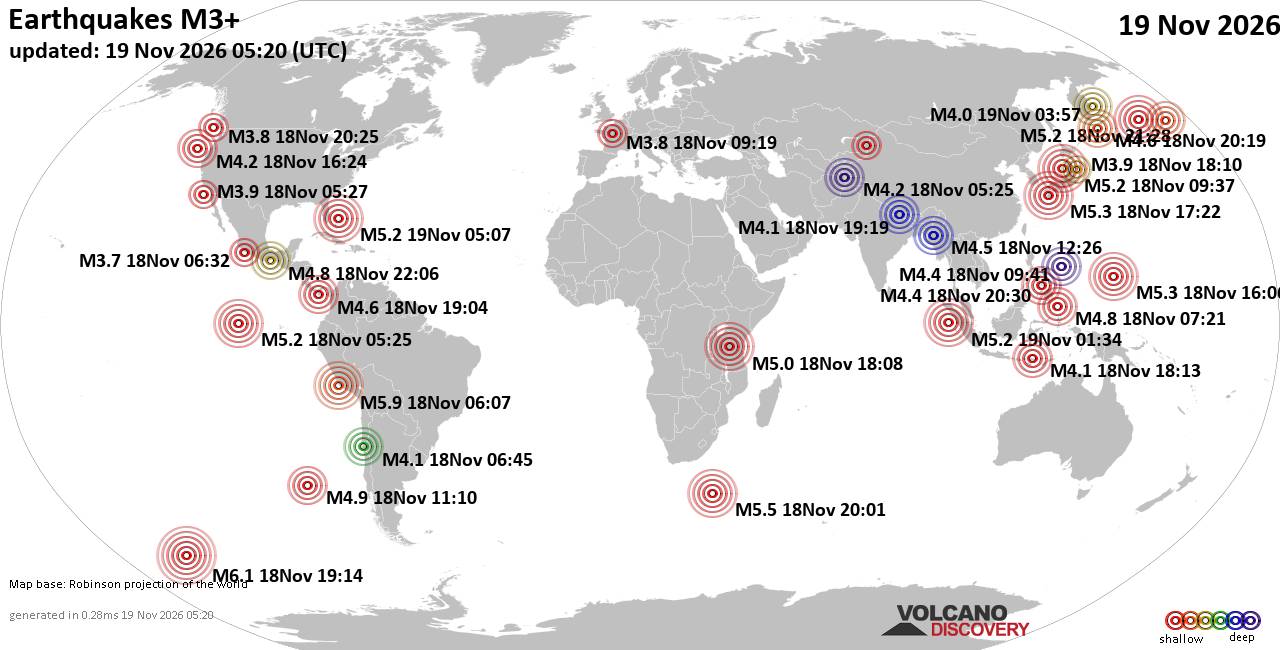
World Earthquake Report for Thursday, 19 November 2026
• Significant magnitude 5.2 quake hits 96 km east of Freeport, Bahamas, after...
• M 1.6 - 68 km WNW of Karluk, Alaska
• M 5.2 - 130 km W of Teluk Dalam, Indonesia
• Strong mag. 5.2 earthquake - Bahamas: Bahama Islands on Thursday, Nov 19, 2...
• M 5.0 - 111 km W of Petrolia, CA
|

#965265
Sun 15 Nov 2026 07:22:AM
|
Joined: Feb 2001
Posts: 800,656
Launch Director
|
|
Launch Director
Joined: Feb 2001
Posts: 800,656 |
SPC Day 2 Fire Weather OutlookSPC Day 2 Fire Weather Outlook 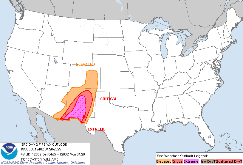
Day 2 Fire Weather Outlook
NWS Storm Prediction Center Norman OK
0121 AM CST Sun Nov 15 2026

Valid 161200Z - 171200Z

...NO CRITICAL AREAS...

...Synopsis...
A robust upper trough will pivot onshore across the West Coast on
D2/Monday as upper ridging shifts eastward into the Great Plains
from the Rockies/Intermountain West. Farther east, weaker upper
troughing will linger across the Southeast as shortwave ridging
aloft builds into the Northeast. This pattern will continue to
support chances for precipitation across much of the West
Coast/Intermountain West, with a separate area of rain chances
forecast along portions of the western/central Gulf Coast. Surface
high pressure will persist across the Ohio Valley, with modestly
warming daytime temperatures and dry conditions forecast across
portions of the Southeast. Minimum RH values of 20-35% should
continue across the lower Mississippi River Valley, but light winds
will continue to limit widespread fire weather concerns.

..Chalmers.. 11/15/2026

...Please see www.spc.noaa.gov/fire for graphic product...
Read morehttps://www.spc.noaa.gov/products/fire_wx/fwdy2.html
|
|



CMS The Best Conveyancing solicitors conveyancing quotes throughout the UK
For any webhosting enquiries please email webmaster@aus-city.com
|
|
Forums60
Topics935,002
Posts969,799
Members2,960
| |
Most Online102,106
Jul 10th, 2026
|
|
|









































