|
|
|
1 members (Alisa),
3,546
guests, and
21
robots. |
|
Key:
Admin,
Global Mod,
Mod
|
|
S |
M |
T |
W |
T |
F |
S |
|
|
|
|
|
|
|
1
|
|
2
|
3
|
4
|
5
|
6
|
7
|
8
|
|
9
|
10
|
11
|
12
|
13
|
14
|
15
|
|
16
|
17
|
18
|
19
|
20
|
21
|
22
|
|
23
|
24
|
25
|
26
|
27
|
28
|
29
|
|
30
|
31
|
|
|
|
|
|
|
There are no members with birthdays on this day. |
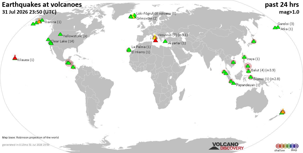
Volcano earthquake report for Friday, 31 Jul 2026
• World Earthquake Report for Friday, 31 July 2026
• Light mag. 3.9 earthquake - Philippine Sea, 57 km east of Sulangan, Philipp...
• Small tremor of magnitude 3.1 just reported 10 km southwest of Naples, Ital...
• Seismic-like event, possible earthquake, reported few minutes ago near Napl...
• Strong mag. 5.0 earthquake - 65 km northeast of Pu'er, Yunnan Sheng, China,...
|

#726831
Sat 22 Jun 2024 10:47:PM
|
Joined: Feb 2001
Posts: 678,976
Launch Director
|
OP

Launch Director
Joined: Feb 2001
Posts: 678,976 |
SPC MD 1375MD 1375 CONCERNING SEVERE POTENTIAL...WATCH UNLIKELY FOR PORTIONS OF EASTERN UTAH INTO WESTERN COLORADO 
Mesoscale Discussion 1375
NWS Storm Prediction Center Norman OK
0332 PM CDT Sat Jun 22 2024

Areas affected...portions of eastern Utah into western Colorado

Concerning...Severe potential...Watch unlikely

Valid 222032Z - 222300Z

Probability of Watch Issuance...20 percent

SUMMARY...The threat for isolated severe wind and hail is increasing
across portions of eastern UT into western CO. A WW issuance is not
currently expected.

DISCUSSION...Thunderstorms are increasing in number and intensity
across eastern UT/western CO along the entrance region of a 300 mb
jet streak, where a well-mixed boundary layer is now in place.
Latest MRMS-MESH radar data suggests some of the stronger storms may
already be producing at least marginally severe (i.e. 1 inch
diameter) hail. Surface temperatures approaching the upper 80s F
beneath 9 C/km tropospheric lapse rates is contributing to 500-1000
J/kg MLCAPE. RAP forecast soundings depict hodographs with modest
low-level curvature but considerable mid-level elongation, which
will promote continued multicell/supercell development through the
afternoon. The strongest storms will be accompanied by some severe
wind/hail threat. However, the severe threat should remain isolated,
and a WW issuance is not currently anticipated.

..Squitieri/Hart.. 06/22/2024

...Please see www.spc.noaa.gov for graphic product...

ATTN...WFO...GJT...SLC...

LAT...LON   37901173 40281098 40861015 40900904 40550753 39370717
            38010711 37390795 37130931 37091013 37231119 37901173
Read morehttps://www.spc.noaa.gov/products/md/md1375.html
|
|



CMS The Best Conveyancing solicitors conveyancing quotes throughout the UK
For any webhosting enquiries please email webmaster@aus-city.com
|
|
Entire Thread
|
 SPC MD 1375
|
Webmaster
|
Sat 22 Jun 2024 10:47:PM
|
|
Forums60
Topics793,629
Posts828,415
Members2,960
| |
Most Online102,106
Jul 10th, 2026
|
|
|
|
|
Copyright 1996 - 2026 by David Cottle. Designed by David Bate Jr. All Rights Reserved.
By using this forum, the user agrees not to transfer any data or technical information received under this agreement to any other entity without the express approval of the AUS-CITY Forum Admins and/or authors of individual posts (Forum Admins and DoD/USSPACECOM for the analysis of satellite tracking data).
Two-line elements (TLE) and all other satellite data presented and distributed via this forum and AUS-CITY mailing lists are distributed with permission from DoD/USSTRATCOM.

|

|