|
|
|
0 members (),
1,914
guests, and
31
robots. |
|
Key:
Admin,
Global Mod,
Mod
|
|
S |
M |
T |
W |
T |
F |
S |
|
|
1
|
2
|
3
|
4
|
5
|
6
|
|
7
|
8
|
9
|
10
|
11
|
12
|
13
|
|
14
|
15
|
16
|
17
|
18
|
19
|
20
|
|
21
|
22
|
23
|
24
|
25
|
26
|
27
|
|
28
|
29
|
30
|
|
|
|
|
|
There are no members with birthdays on this day. |
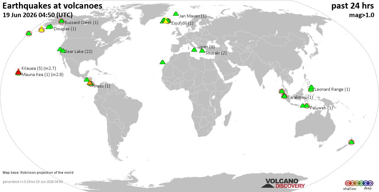
Volcano earthquake report for Friday, 19 Jun 2026
• Moderate mag. 4.0 earthquake - 231 km southwest of Invercargill, Southland,...
• Moderate mag. 4.8 earthquake - St. Helena: Central Mid-Atlantic Ridge on Fr...
• Moderate mag. 4.0 earthquake - Badakhshan, 193 km northeast of Kabul, Kabul...
• Moderate mag. 4.5 earthquake - 25 km east of Kuhdasht, Lorestan Province, I...
• Light mag. 3.9 earthquake - 14 km east of Takayama, Gifu, Japan, on Friday,...
|

#737787
Mon 16 Sep 2024 08:56:AM
|
Joined: Feb 2001
Posts: 678,976
Launch Director
|
OP

Launch Director
Joined: Feb 2001
Posts: 678,976 |
SPC Sep 16, 2024 Day 4-8 Severe Weather OutlookDay 4-8 Outlook 
Day 4-8 Convective Outlook
NWS Storm Prediction Center Norman OK
0353 AM CDT Mon Sep 16 2024

Valid 191200Z - 241200Z

...DISCUSSION...
...D4/Upper Midwest...
Lower-end severe potential remains evident on Thursday afternoon to
evening across a focused portion of the Upper Midwest, centered on
the eastern Dakotas to western MN per latest guidance. A shortwave
trough over the southern Prairie Provinces into the northern Great
Plains should gradually move east. An attendant north/south-oriented
cold front should similarly progress across the Dakotas towards
western MN. In the mid-levels, a plume of steep lapse rates should
be coincident with a belt of enhanced west-southwesterly flow. The
warm-moist sector ahead of the front will likely be confined with
decreasing boundary-layer moisture along/east of the Upper MS
Valley. As such, the overall threat area will probably be fairly
narrow and predictability is too low for a 15 percent highlight.

...D6-7/Southern High Plains to Mid-MO Valley...
The next shortwave trough that amplifies into the Southwest should
remain positive tilt and slow moving, until the weekend when
guidance consensus suggests it accelerates northeastward. The
attendant belt of enhanced mid-level flow around this trough appears
spatially confined, as a ridge dominates from the Lower Rio Grande
Valley to southeast Canada. Coupled with muted mid-level lapse rates
over most of the Great Plains, severe potential appears marginal.
Read morehttps://www.spc.noaa.gov/products/exper/day4-8/
|
|



CMS The Best Conveyancing solicitors conveyancing quotes throughout the UK
For any webhosting enquiries please email webmaster@aus-city.com
|
|
Entire Thread
|
 SPC Sep 16, 2024 Day 4-8 Severe Weather Outlook
|
Webmaster
|
Mon 16 Sep 2024 08:56:AM
|
|
Forums60
Topics783,058
Posts817,818
Members2,960
| |
Most Online22,463
May 9th, 2026
|
|
|
|
|
Copyright 1996 - 2026 by David Cottle. Designed by David Bate Jr. All Rights Reserved.
By using this forum, the user agrees not to transfer any data or technical information received under this agreement to any other entity without the express approval of the AUS-CITY Forum Admins and/or authors of individual posts (Forum Admins and DoD/USSPACECOM for the analysis of satellite tracking data).
Two-line elements (TLE) and all other satellite data presented and distributed via this forum and AUS-CITY mailing lists are distributed with permission from DoD/USSTRATCOM.

|

|