|
|
|
0 members (),
1,085
guests, and
21
robots. |
|
Key:
Admin,
Global Mod,
Mod
|
|
S |
M |
T |
W |
T |
F |
S |
|
|
1
|
2
|
3
|
4
|
5
|
6
|
|
7
|
8
|
9
|
10
|
11
|
12
|
13
|
|
14
|
15
|
16
|
17
|
18
|
19
|
20
|
|
21
|
22
|
23
|
24
|
25
|
26
|
27
|
|
28
|
29
|
30
|
|
|
|
|
|
There are no members with birthdays on this day. |
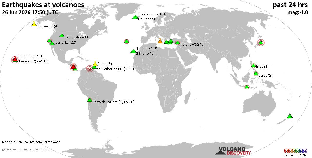
Volcano earthquake report for Friday, 26 Jun 2026
• Moderate mag. 4.7 earthquake - Indonesia: Northern Molucca Sea on Friday, J...
• World Earthquake Report for Friday, 26 June 2026
• Significant 5.0 quake hits near La Romana, Provincia de La Romana, Dominica...
• No Tsunami Threat After Magnitude 5.0 Earthquake Near Isla Mona
• Moderate mag. 4.9 earthquake - Caribbean Sea, Provincia de San Cristobal, 3...
|

#737906
Mon 16 Sep 2024 07:17:PM
|
Joined: Feb 2001
Posts: 678,976
Launch Director
|
OP

Launch Director
Joined: Feb 2001
Posts: 678,976 |
SPC Sep 16, 2024 1930 UTC Day 3 Severe Thunderstorm OutlookSPC 1930Z Day 3 Outlook 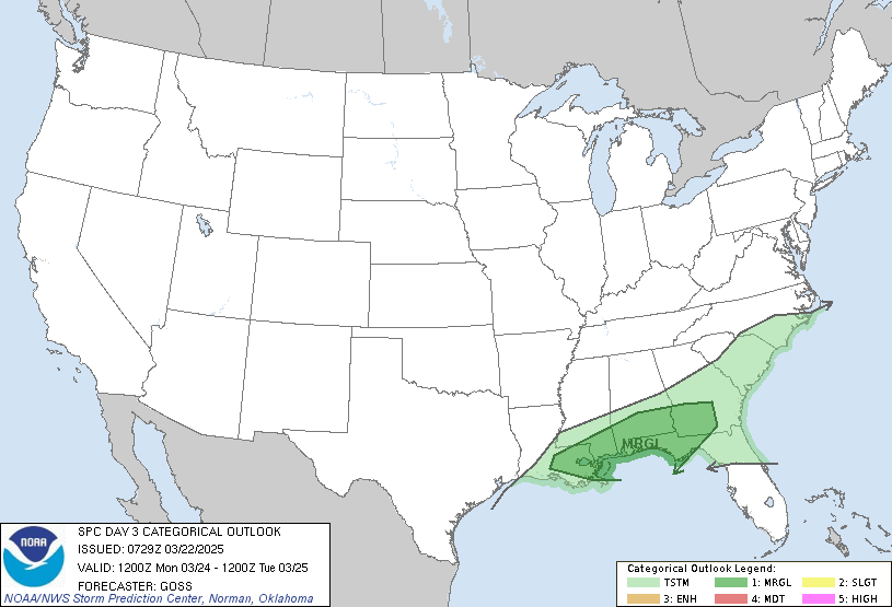
Day 3 Convective Outlook
NWS Storm Prediction Center Norman OK
0215 PM CDT Mon Sep 16 2024

Valid 181200Z - 191200Z

...NO SEVERE THUNDERSTORM AREAS FORECAST...

...SUMMARY...
Organized severe thunderstorms are not expected on Wednesday.

...Great Plains...

Forecast guidance at 12z remains similar to previous cycles at Day
3/Wed. The cyclone over eastern MT will become stacked through the
period and only progress modestly northeast toward ND and southern
SK/MB by 12z Thursday. Enhanced southwesterly mid/upper flow ahead
of this feature will overspread the northern/central Plains, while
southerly low-level flow allows 60s F dewpoints to remain in place
from the southern Plains to the MO and Red River (north) Valleys.
Convection may be ongoing across parts of the mid-MO Valley vicinity
Wednesday morning, with areas of cloud debris expected across the
broader Plains. This will result in some uncertainty in airmass
recovery/destabilization during the afternoon. While outflow
boundaries and pockets of stronger heating may focus mesoscale areas
of thunderstorm potential during peak heating through early evening
from the eastern Dakotas/MN south/southwest into the TX Panhandle,
severe potential is uncertain. Large-scale ascent will remain
nebulous across much of the Plains, and midlevel lapse rates will be
modest due to relatively warm temperatures aloft. Vertical shear
could support some organized/severe risk from eastern SD/NE into KS,
but uncertainty and the conditional nature of potential risk
precludes low severe probabilities at this time.

..Leitman.. 09/16/2024
Read morehttps://www.spc.noaa.gov/products/outlook/day3otlk_1930.html
|
|



CMS The Best Conveyancing solicitors conveyancing quotes throughout the UK
For any webhosting enquiries please email webmaster@aus-city.com
|
|
Entire Thread
|
 SPC Sep 16, 2024 1930 UTC Day 3 Severe Thunderstorm Outlook
|
Webmaster
|
Mon 16 Sep 2024 07:17:PM
|
|
Forums60
Topics784,288
Posts819,053
Members2,960
| |
Most Online22,463
May 9th, 2026
|
|
|
|
|
Copyright 1996 - 2026 by David Cottle. Designed by David Bate Jr. All Rights Reserved.
By using this forum, the user agrees not to transfer any data or technical information received under this agreement to any other entity without the express approval of the AUS-CITY Forum Admins and/or authors of individual posts (Forum Admins and DoD/USSPACECOM for the analysis of satellite tracking data).
Two-line elements (TLE) and all other satellite data presented and distributed via this forum and AUS-CITY mailing lists are distributed with permission from DoD/USSTRATCOM.

|

|