|
|
|
0 members (),
821
guests, and
23
robots. |
|
Key:
Admin,
Global Mod,
Mod
|
|
S |
M |
T |
W |
T |
F |
S |
|
|
|
1
|
2
|
3
|
4
|
5
|
|
6
|
7
|
8
|
9
|
10
|
11
|
12
|
|
13
|
14
|
15
|
16
|
17
|
18
|
19
|
|
20
|
21
|
22
|
23
|
24
|
25
|
26
|
|
27
|
28
|
29
|
30
|
|
|
|
|
There are no members with birthdays on this day. |
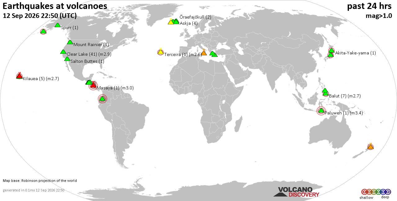
Volcano earthquake report for Saturday, 12 September 2026
• World Earthquake Report for Saturday, 12 September 2026
• Moderate but deep magnitude 5.3 quake hits 74 km southeast of Nakanoshima, ...
• Strong mag. 5.3 earthquake - Ryukyu Islands, Japan, on Sunday, Sep 13, 2026...
• Seismic-like event, possible earthquake, reported minutes ago near Pasto, N...
• Moderate mag. 4.3 earthquake - Philippine Sea, 34 km south of Miyake, Tokyo...
|

#741864
Mon 21 Oct 2024 05:28:AM
|
Joined: Feb 2001
Posts: 678,977
Launch Director
|
|
Launch Director
Joined: Feb 2001
Posts: 678,977 |
SPC Oct 21, 2024 0600 UTC Day 1 Convective OutlookSPC 1200Z Day 1 Outlook 
Day 1 Convective Outlook
NWS Storm Prediction Center Norman OK
1224 AM CDT Mon Oct 21 2024

Valid 211200Z - 221200Z

...THERE IS A MARGINAL RISK OF SEVERE THUNDERSTORMS ACROSS THE
CENTRAL PLAINS...

...SUMMARY...
Isolated severe thunderstorms are possible across the central
Plains, mainly during the afternoon to early evening.

...Central Plains...

Four Corners upper low is finally ejecting northeast and should
advance into the central High Plains by 18z before moving into the
middle MS Valley by the end of the period. In response to this
feature, notable LLJ will shift from the High Plains at sunrise into
central KS/eastern NE by late afternoon. At the surface, a sharp lee
trough will be dislodged early, and a weak wave is expected to
develop along the KS/NE border. This will ensure southeasterly
low-level flow across northern KS into central NE through peak
heating. Large-scale pattern favors focused low-level convergence
over southern NE/northern KS but the magnitude of instability is not
expected to be that strong, with perhaps MLCAPE exceeding 1000 J/kg
across the MRGL risk where surface dew points are able to rise into
the mid 50s. While buoyancy is not forecast to be that significant,
modestly steep lapse rates and 90m 12hr height falls do warrant
attention, as high-level diffluent flow will prove favorable for
robust updrafts.

Scattered convection will likely be ongoing at the beginning of the
period, along the leading edge of stronger forcing, within the
low-level warm advection corridor. This activity should propagate
east during the day with the potential for strong/severe storms
developing in its wake where boundary layer warms. Current thinking
is isolated severe storms, including supercells, will evolve by mid
afternoon within the left exit region of the mid-level jet. At this
time will maintain MRGL risk, but there was some consideration for
introducing a SLGT, and this may be need in later outlooks.

..Darrow.. 10/21/2024
Read morehttps://www.spc.noaa.gov/products/outlook/day1otlk_1200.html
|
|



CMS The Best Conveyancing solicitors conveyancing quotes throughout the UK
For any webhosting enquiries please email webmaster@aus-city.com
|
|
Entire Thread
|
 SPC Oct 21, 2024 0600 UTC Day 1 Convective Outlook
|
Webmaster
|
Mon 21 Oct 2024 05:28:AM
|
|
Forums60
Topics825,435
Posts860,228
Members2,960
| |
Most Online102,106
Jul 10th, 2026
|
|
|
|
|

|





































