|
0 members (),
1,477
guests, and
33
robots. |
|
Key:
Admin,
Global Mod,
Mod
|
|
S |
M |
T |
W |
T |
F |
S |
|
|
|
|
|
1
|
2
|
3
|
|
4
|
5
|
6
|
7
|
8
|
9
|
10
|
|
11
|
12
|
13
|
14
|
15
|
16
|
17
|
|
18
|
19
|
20
|
21
|
22
|
23
|
24
|
|
25
|
26
|
27
|
28
|
29
|
30
|
31
|
|
There are no members with birthdays on this day. |
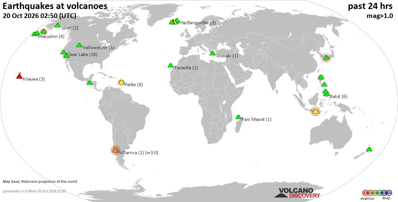
Volcano earthquake report for Tuesday, 20 October 2026
• M 1.8 - 4 km NW of The Geysers, CA
• M 2.1 - 46 km WNW of Tyonek, Alaska
• M 1.5 - 57 km SSE of Manley Hot Springs, Alaska
• M 3.1 - 254 km SSE of Perryville, Alaska
• M 0.3 - 3 km WSW of Anza, CA
|

#865960
Wed 16 Sep 2026 09:15:PM
|
Joined: Feb 2001
Posts: 678,977
Launch Director
|
|
Launch Director
Joined: Feb 2001
Posts: 678,977 |
SPC MD 2302MD 2302 CONCERNING SEVERE POTENTIAL...WATCH UNLIKELY FOR EAST-CENTRAL INDIANA INTO CENTRAL OHIO 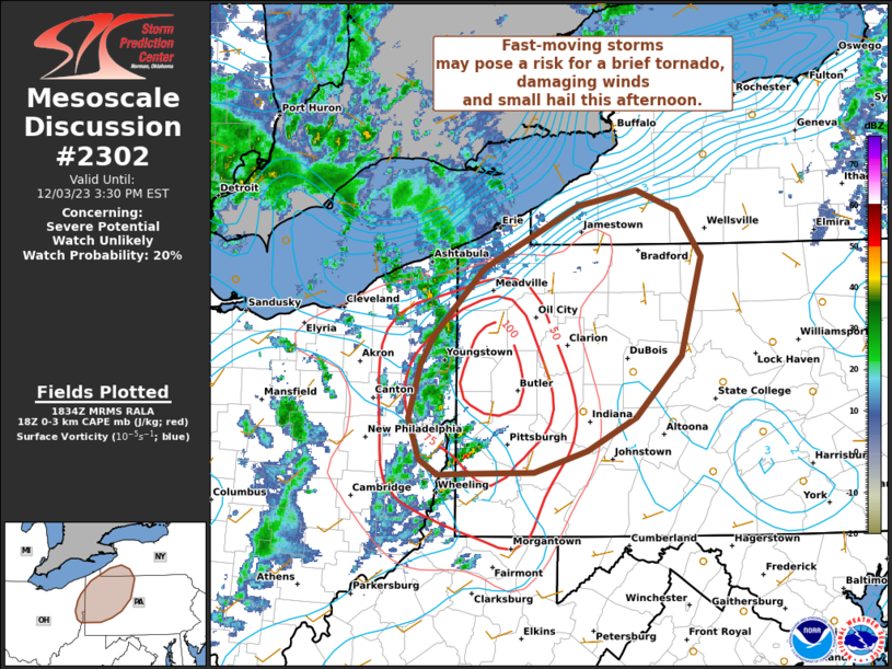
Mesoscale Discussion 2302
NWS Storm Prediction Center Norman OK
0246 PM CDT Wed Sep 16 2026

Areas affected...east-central Indiana into central Ohio

Concerning...Severe potential...Watch unlikely

Valid 161946Z - 162145Z

Probability of Watch Issuance...5 percent

SUMMARY...Isolated gusty winds of 45-60 mph will be possible with
stronger thunderstorms developing through early evening. Overall
risk is expected to remain limited, and a severe thunderstorm watch
is not expected.

DISCUSSION...Isolated thunderstorms are developing near the IN/OH
state border this afternoon. This activity is developing ahead of a
stalled front and on the southern periphery of stronger effective
shear located north of this boundary. Stronger heating across
east-central IN into central OH has allowed temperatures to warm
into the 80s to near 90 F amid mid 70s F dewpoints, resulting in
moderate instability. Effective shear magnitudes around 20-30 kt may
allow for some storm organization. However, weak midlevel lapse
rates will limit longevity of any stronger/better organized
updrafts. Nevertheless, steepened low-level lapse rates and high PW
values could support sporadic strong outflow wind gusts. Overall,
the risk is expected to remain limited and mostly sub-severe wind
gusts are anticipated, precluding watch issuance.

..Leitman/Hart.. 09/16/2026

...Please see www.spc.noaa.gov for graphic product...

ATTN...WFO...PBZ...RLX...CLE...ILN...IWX...IND...

LAT...LON   40178559 40798440 40878292 40458191 40008182 39698200
            39448292 39368434 39548533 39888566 40178559

MOST PROBABLE PEAK WIND GUST...UP TO 60 MPH
Read morehttps://www.spc.noaa.gov/products/md/md2302.html
|
|



CMS The Best Conveyancing solicitors conveyancing quotes throughout the UK
For any webhosting enquiries please email webmaster@aus-city.com
|
|
Entire Thread
|
 SPC MD 2302
|
Webmaster
|
Wed 16 Sep 2026 09:15:PM
|
|
Forums60
Topics884,386
Posts919,183
Members2,960
| |
Most Online102,106
Jul 10th, 2026
|
|
|









































