|
|
|
0 members (),
3,655
guests, and
26
robots. |
|
Key:
Admin,
Global Mod,
Mod
|
|
S |
M |
T |
W |
T |
F |
S |
|
|
|
1
|
2
|
3
|
4
|
5
|
|
6
|
7
|
8
|
9
|
10
|
11
|
12
|
|
13
|
14
|
15
|
16
|
17
|
18
|
19
|
|
20
|
21
|
22
|
23
|
24
|
25
|
26
|
|
27
|
28
|
29
|
30
|
|
|
|
|
There are no members with birthdays on this day. |
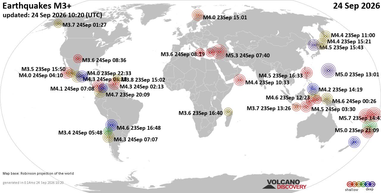
World Earthquake Report for Thursday, 24 September 2026
• Moderate mag. 4.3 earthquake - Madagascar: Mozambique Channel on Thursday, ...
• Small magnitude 3.9 earthquake hits near Hastings, Hastings District, Hawke...
• Volcano earthquake report for Thursday, 24 September 2026
• Light mag. 3.9 earthquake - South Pacific Ocean, 10.2 km south of Hastings,...
• Moderate magnitude 4.1 quake hits 31 miles southeast of Midland, Texas, Uni...
|
|
|
Joined: Feb 2001
Posts: 678,977
Launch Director
|
|
Launch Director
Joined: Feb 2001
Posts: 678,977 |
Eastern Pacific Tropical Weather Outlook


000
ABPZ20 KNHC 241149
TWOEP
Tropical Weather Outlook
NWS National Hurricane Center Miami FL
500 AM PDT Thu Sep 24 2026
For the eastern and central North Pacific east of 180 longitude:
Active Systems:
The National Hurricane Center is issuing advisories on Hurricane
Polo, located about 100 miles offshore of southwestern Mexico, on
Hurricane Odalys, located well west-southwest of the southern tip of
Baja California, and on Tropical Storm Nolo, located a few hundred
miles south of the Big Island of Hawaii.
South of the Gulf of Tehuantepec:
An area of low pressure is expected to form in a couple of days to
the south of the Gulf of Tehuantepec. Afterwards, environmental
conditions should be favorable for gradual development, and a
tropical depression is likely to form early next week as the system
moves slowly west-northwestward to northwestward, parallel to the
coast of southern and southwestern Mexico.
* Formation chance through 48 hours...low...near 0 percent.
* Formation chance through 7 days...high...80 percent.
Well East-Southeast of the Hawaiian Islands:
An area of low pressure could form about 1000 miles east-southeast
of the Hawaiian Islands over the weekend. Environmental conditions
could support some gradual development of this system thereafter as
it moves generally northeastward, remaining well east-southeast of
the Hawaiian Islands.
* Formation chance through 48 hours...low...near 0 percent.
* Formation chance through 7 days...low...30 percent.
$$
Forecaster Beven
|
|



CMS The Best Conveyancing solicitors conveyancing quotes throughout the UK
For any webhosting enquiries please email webmaster@aus-city.com
|
|
Entire Thread
|

 Eastern Pacific Tropical Weather Outlook
|
Webmaster
|
3 hours ago
|
|
Forums60
Topics840,445
Posts875,240
Members2,960
| |
Most Online102,106
Jul 10th, 2026
|
|
|
|
|

|





































