|
|
|
0 members (),
2,533
guests, and
24
robots. |
|
Key:
Admin,
Global Mod,
Mod
|
|
S |
M |
T |
W |
T |
F |
S |
|
|
|
|
|
1
|
2
|
3
|
|
4
|
5
|
6
|
7
|
8
|
9
|
10
|
|
11
|
12
|
13
|
14
|
15
|
16
|
17
|
|
18
|
19
|
20
|
21
|
22
|
23
|
24
|
|
25
|
26
|
27
|
28
|
29
|
30
|
31
|
|
There are no members with birthdays on this day. |
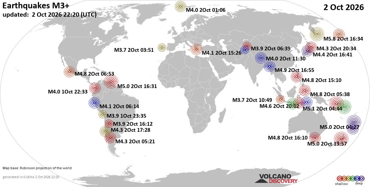
World Earthquake Report for Friday, 2 October 2026
• M 0.8 - 85 km NW of Karluk, Alaska
• M 2.5 - 58 km WNW of Nikiski, Alaska
• M 2.4 - 6 km WNW of Petaluma, CA
• M -0.7 - 63 km ENE of Pedro Bay, Alaska
• M 2.1 - 115 km N of Yakutat, Alaska
• M 1.8 - 66 km WNW of Happy Valley, Alaska
|
|
|
Joined: Feb 2001
Posts: 678,977
Launch Director
|
|
Launch Director
Joined: Feb 2001
Posts: 678,977 |
SPC Oct 2, 2026 2000 UTC Day 1 Convective OutlookSPC 2000Z Day 1 Outlook 
Day 1 Convective Outlook
NWS Storm Prediction Center Norman OK
0254 PM CDT Fri Oct 02 2026

Valid 022000Z - 031200Z

...NO SEVERE THUNDERSTORM AREAS FORECAST...

...SUMMARY...
Severe thunderstorm potential should remain low through tonight.

...20z Update...
No changes are needed to the previous outlook. See the discussion
below for more details.

..Karstens/Thornton.. 10/02/2026

.PREV DISCUSSION... /ISSUED 1122 AM CDT Fri Oct 02 2026/

...Synopsis and Discussion...
An upper trough will continue progressing eastward across the
Northeast and Mid-Atlantic today, as a surface cold front advances
east-southeastward over these regions and the Southeast/southern
Plains through the period. 12Z observed soundings ahead of the front
from the Mid-Atlantic to Southeast show very poor lapse rates aloft
(i.e., 700-500 mb lapse rates of 4-5.5 C/km), which will likely
limit the development of any more than weak instability and hinder
overall updraft strength. While locally gusty winds could still
occur with low-topped showers/thunderstorms across the Mid-Atlantic
given the presence of modestly enhanced low/mid-level
west-southwesterly flow, the potential for organized clusters
capable of producing severe/damaging winds still appears low. Weaker
flow across the TN Valley and central Gulf Coast states will limit
updraft organization, but marginally greater instability should
support isolated to scattered thunderstorm coverage through the
afternoon along/ahead of the cold front.
Read morehttps://www.spc.noaa.gov/products/outlook/day1otlk_2000.html
|
|



CMS The Best Conveyancing solicitors conveyancing quotes throughout the UK
For any webhosting enquiries please email webmaster@aus-city.com
|
|
Entire Thread
|

 SPC Oct 2, 2026 2000 UTC Day 1 Convective Outlook
|
Webmaster
|
3 hours ago
|
|
Forums60
Topics854,101
Posts888,896
Members2,960
| |
Most Online102,106
Jul 10th, 2026
|
|
|
|
|

|









































