|
|
|
0 members (),
13,577
guests, and
233
robots. |
|
Key:
Admin,
Global Mod,
Mod
|
|
S |
M |
T |
W |
T |
F |
S |
|
|
|
|
|
|
|
1
|
|
2
|
3
|
4
|
5
|
6
|
7
|
8
|
|
9
|
10
|
11
|
12
|
13
|
14
|
15
|
|
16
|
17
|
18
|
19
|
20
|
21
|
22
|
|
23
|
24
|
25
|
26
|
27
|
28
|
29
|
|
30
|
31
|
|
|
|
|
|
|
There are no members with birthdays on this day. |
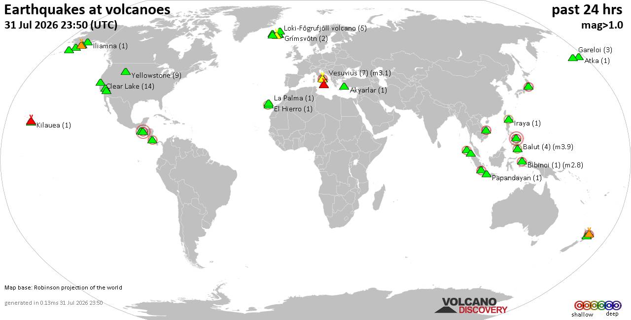
Volcano earthquake report for Friday, 31 Jul 2026
• World Earthquake Report for Friday, 31 July 2026
• Light mag. 3.9 earthquake - Philippine Sea, 57 km east of Sulangan, Philipp...
• Small tremor of magnitude 3.1 just reported 10 km southwest of Naples, Ital...
• Seismic-like event, possible earthquake, reported few minutes ago near Napl...
• Strong mag. 5.0 earthquake - 65 km northeast of Pu'er, Yunnan Sheng, China,...
|

#699598
Tue 10 Oct 2023 08:42:AM
|
Joined: Feb 2001
Posts: 678,976
Launch Director
|
OP

Launch Director
Joined: Feb 2001
Posts: 678,976 |
Issued at 300 AM MDT Tue Oct 10 2023
000
WTPZ45 KNHC 100842
TCDEP5

Hurricane Lidia Discussion Number  29
NWS National Hurricane Center Miami FL       EP152023
300 AM MDT Tue Oct 10 2023

Lidia continues to have robust burst of convection this morning,
with cold cloud tops near -90 degrees Celsius. The recent
convective burst is near the well-defined mid-level core that was
depicted from an earlier SSMIS microwave pass. Subjective Dvorak
final T-numbers from TAFB and SAB are T4.0 (65 kt) and T4.5 (77 kt),
respectively. UW-CIMSS objective estimates range between 70-77 kt as
well.  Based on the improved satellite imagery and recent
subjective and objective estimates, the initial intensity is raised
to 75 kt.

Lidia's estimated motion is east-northeast or 70 degrees at 10 kt.
The hurricane should move faster to the east-northeast later today
ahead of a mid- to upper-level trough advancing from the northwest.
The center of Lidia will approach the west-central coast of Mexico
later this afternoon and evening, with the system forecast to move
inland along the west-central coast of Mexico within the hurricane
warning area by tonight. The track guidance has once again trended
southward this cycle. The NHC forecast has been nudged further south
by about 20 n mi, and it lies close to the multi-model consensus
aids.

Low vertical wind shear and warm sea surface temperatures along the
track of Lidia should allow for further strengthening up until
landfall, consistent with the regional hurricane models and the
global model suite.  While the 12 h intensity forecast of
90 kt is unchanged from the peak of the previous forecast (near the
upper-end of the intensity guidance), Lidia could intensify further
up to landfall. Increasing shear and the high terrain of Mexico
will result in rapid weakening after landfall and Lidia is expected
to dissipate by 36 hours.

Key Messages:

1. Lidia is expected to continue to strengthen as it approaches
west-central Mexico today. Dangerous hurricane-force winds are
expected within the Hurricane Warning area beginning this afternoon.

2. Heavy rains from Lidia will likely produce flash and urban
flooding, along with possible mudslides in areas of higher terrain
across the the state of Nayarit, southern portions of the state of
Sinaloa, and coastal portions of the state of Jalisco in western
Mexico.

3. A dangerous storm surge is expected near and to the south of
where the center of Lidia moves onshore along the coast of
west-central Mexico.

4. Swells from Lidia will cause dangerous surf and rip current
conditions along the west coast of Mexico and the Baja California
peninsula during the next couple of days.


FORECAST POSITIONS AND MAX WINDS

INIT  10/0900Z 18.6N 109.2W   75 KT  85 MPH
 12H  10/1800Z 19.5N 107.2W   90 KT 105 MPH
 24H  11/0600Z 21.1N 104.4W   45 KT  50 MPH...INLAND
 36H  11/1800Z...DISSIPATED

$$
Forecaster Kelly
Source: Hurricane Lidia Forecast Discussion Number 29
|
|



CMS The Best Conveyancing solicitors conveyancing quotes throughout the UK
For any webhosting enquiries please email webmaster@aus-city.com
|
|
Forums60
Topics793,692
Posts828,478
Members2,960
| |
Most Online102,106
Jul 10th, 2026
|
|
|
|
|

|