|
|
|
0 members (),
8,179
guests, and
24
robots. |
|
Key:
Admin,
Global Mod,
Mod
|
|
S |
M |
T |
W |
T |
F |
S |
|
1
|
2
|
3
|
4
|
5
|
6
|
7
|
|
8
|
9
|
10
|
11
|
12
|
13
|
14
|
|
15
|
16
|
17
|
18
|
19
|
20
|
21
|
|
22
|
23
|
24
|
25
|
26
|
27
|
28
|
|
29
|
30
|
31
|
|
|
|
|
|
There are no members with birthdays on this day. |

#724607
Wed 29 May 2024 06:15:AM
|
Joined: Feb 2001
Posts: 381,904
Launch Director
|
OP

Launch Director
Joined: Feb 2001
Posts: 381,904 |
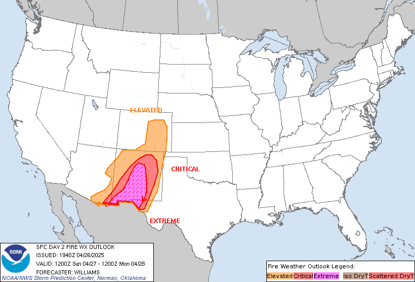
SPC Day 2 Fire Weather OutlookSPC Day 2 Fire Weather Outlook 
Day 2 Fire Weather Outlook
NWS Storm Prediction Center Norman OK
0113 AM CDT Wed May 29 2024

Valid 301200Z - 311200Z

...NO CRITICAL AREAS...

...Synopsis...
Mid-level flow will continue to weaken across the Southwest
Thursday, as a mid to upper-level negatively tilted trough
progresses east northeastward over the northern Rockies. An
associated Pacific cold front will make its way as far south as
southwestern UT Thursday morning, and only weak westerly surface
winds are expected ahead of it through the afternoon across most of
AZ and NM. The exception may be near the Sacramento Mountains of NM,
where sustained wind speeds near 15-20 mph are anticipated late in
the afternoon/early evening. This is also where single-digit RH will
reside. However, confidence is too low to introduce an Elevated area
at this time since meteorological fire spread conditions will be
brief and fairly isolated.

..Barnes.. 05/29/2024

...Please see www.spc.noaa.gov/fire for graphic product...
Read morehttps://www.spc.noaa.gov/products/fire_wx/fwdy2.html
|
|


CMS The Best Conveyancing solicitors conveyancing quotes throughout the UK
For any webhosting enquiries please email webmaster@aus-city.com
|
|
Forums60
Topics767,046
Posts801,807
Members2,958
| |
Most Online17,963
Jan 15th, 2026
|
|
|
|
|
Copyright 1996 - 2026 by David Cottle. Designed by David Bate Jr. All Rights Reserved.
By using this forum, the user agrees not to transfer any data or technical information received under the agreement, to any other entity without the express approval of the AUS-CITY Forum Admins and/or authors of individual posts (Forum Admins and DoD/USSPACECOM for the analysis of satellite tracking data).
Two-line elements (TLE) and all other satellite data presented and distributed via this forum and e-mail lists of AUS-CITY are distributed with permission from DoD/USSTRATCOM.


Reprise Hosting


|

|