|
|
|
0 members (),
3,204
guests, and
24
robots. |
|
Key:
Admin,
Global Mod,
Mod
|
|
S |
M |
T |
W |
T |
F |
S |
|
1
|
2
|
3
|
4
|
5
|
6
|
7
|
|
8
|
9
|
10
|
11
|
12
|
13
|
14
|
|
15
|
16
|
17
|
18
|
19
|
20
|
21
|
|
22
|
23
|
24
|
25
|
26
|
27
|
28
|
|
There are no members with birthdays on this day. |
|
|
|
|
|
|
|
|
|
|
|
|
|
|
|
|
|
|
you felded
by Webmaster - Sun 01 Feb 2026 12:00:AM
|

#752268
Fri 24 Jan 2025 07:36:AM
|
Joined: Feb 2001
Posts: 381,904
Launch Director
|
OP

Launch Director
Joined: Feb 2001
Posts: 381,904 |
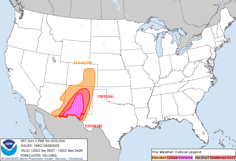
SPC Day 2 Fire Weather OutlookSPC Day 2 Fire Weather Outlook 
Day 2 Fire Weather Outlook
NWS Storm Prediction Center Norman OK
0134 AM CST Fri Jan 24 2025

Valid 251200Z - 261200Z

...Synopsis...
Fire weather concerns are expected to emerge across portions of
Arizona by Saturday afternoon as low-level winds increase in
response to a deepening upper wave along the West Coast. The
breakdown of an upper ridge over the West Coast is underway ahead of
an approaching trough based on recent water-vapor imagery and
upper-air analyses. Broad surface pressure falls are anticipated
across the greater inter-mountain West/High Plains over the next 24
hours, but will intensify over the Southwest through Saturday as the
upper wave deepens along the southern CA coast. Recent forecast
guidance suggests south/southeasterly winds between 15-25 mph will
be likely - especially in the lee/northern slopes of the Mogollon
Rim and across south-central AZ by late afternoon.

Extensive mid/high-level cloud cover is anticipated through much of
the day as mid-level isentropic ascent increases ahead of the
deepening upper trough. However, 07 UTC surface observations sampled
a very dry air mass across southern to central AZ characterized by
dewpoints between -5 to -15 F. Consequently, even muted diurnal
heating should promote RH reductions into the single digits to low
teens, which will support elevated to locally critical fire weather
conditions. Recent fuel analyses show ERC values generally
near/above the 80th percentile - likely the result of 30-day
rainfall totals between 2 to 5% of normal, which should support the
fire weather concern.

..Moore.. 01/24/2025

...Please see www.spc.noaa.gov/fire for graphic product...
Read morehttps://www.spc.noaa.gov/products/fire_wx/fwdy2.html
|
|


CMS The Best Conveyancing solicitors conveyancing quotes throughout the UK
For any webhosting enquiries please email webmaster@aus-city.com
|
|
Forums60
Topics759,855
Posts794,573
Members2,958
| |
Most Online17,963
Jan 15th, 2026
|
|
|
|
|
Copyright 1996 - 2026 by David Cottle. Designed by David Bate Jr. All Rights Reserved.
By using this forum, the user agrees not to transfer any data or technical information received under the agreement, to any other entity without the express approval of the AUS-CITY Forum Admins and/or authors of individual posts (Forum Admins and DoD/USSPACECOM for the analysis of satellite tracking data).
Two-line elements (TLE) and all other satellite data presented and distributed via this forum and e-mail lists of AUS-CITY are distributed with permission from DoD/USSTRATCOM.


Reprise Hosting


|

|