|
0 members (),
1,163
guests, and
22
robots. |
|
Key:
Admin,
Global Mod,
Mod
|
|
S |
M |
T |
W |
T |
F |
S |
|
|
|
1
|
2
|
3
|
4
|
5
|
|
6
|
7
|
8
|
9
|
10
|
11
|
12
|
|
13
|
14
|
15
|
16
|
17
|
18
|
19
|
|
20
|
21
|
22
|
23
|
24
|
25
|
26
|
|
27
|
28
|
29
|
30
|
|
|
|
|
There are no members with birthdays on this day. |
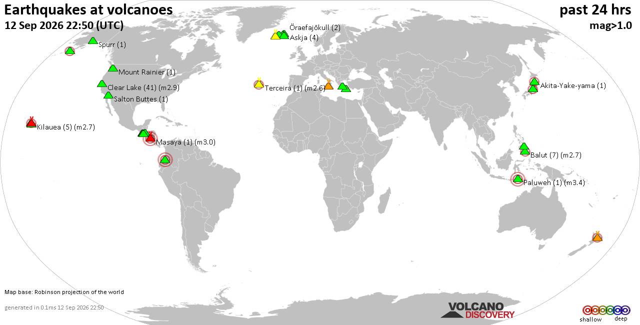
Volcano earthquake report for Saturday, 12 September 2026
• World Earthquake Report for Saturday, 12 September 2026
• Moderate but deep magnitude 5.3 quake hits 74 km southeast of Nakanoshima, ...
• Strong mag. 5.3 earthquake - Ryukyu Islands, Japan, on Sunday, Sep 13, 2026...
• Seismic-like event, possible earthquake, reported minutes ago near Pasto, N...
• Moderate mag. 4.3 earthquake - Philippine Sea, 34 km south of Miyake, Tokyo...
|

#757114
Tue 11 Mar 2025 06:39:PM
|
Joined: Feb 2001
Posts: 678,977
Launch Director
|
|
Launch Director
Joined: Feb 2001
Posts: 678,977 |
SPC Day 2 Fire Weather OutlookSPC Day 2 Fire Weather Outlook 
Day 2 Fire Weather Outlook
NWS Storm Prediction Center Norman OK
0137 PM CDT Tue Mar 11 2025

Valid 121200Z - 131200Z

...CRITICAL FIRE WEATHER AREA FOR FAR SOUTHEAST NEW MEXICO INTO MUCH
OF WESTERN AND CENTRAL TEXAS...

The forecast remains on track, and no appreciable changes were made
with this update. For details, see the previous discussion below.

..Weinman.. 03/11/2025

.PREV DISCUSSION... /ISSUED 0158 AM CDT Tue Mar 11 2025/

...Synopsis...
A mid-level trough will eject into the southern High Plains and
traverse the state of Texas tomorrow (Wednesday), supporting strong
surface low development and the eastward surging of a dryline during
the afternoon. Behind the dryline, very dry and windy conditions
will encourage dangerous wildfire-spread potential. By afternoon
peak heating, the dryline is poised to approach the I-35 corridor,
with sustained westerly surface winds over 25 mph amid 10-15 percent
RH becoming common in the post dryline environment, from eastern New
Mexico into western and central Texas. Several guidance members are
also depicting brief bouts of Extremely Critical conditions across
portions of western and central Texas, though these conditions do
not appear widespread enough for Extremely Critical highlights at
this time. Nonetheless, the aforementioned winds and RH will be
overlapping dry fuels, some of which have yet to experience
appreciable rainfall, so high-end Critical fire weather conditions
are expected for much of western into central Texas.

...Please see www.spc.noaa.gov/fire for graphic product...
Read morehttps://www.spc.noaa.gov/products/fire_wx/fwdy2.html
|
|



CMS The Best Conveyancing solicitors conveyancing quotes throughout the UK
For any webhosting enquiries please email webmaster@aus-city.com
|
|
Forums60
Topics825,486
Posts860,279
Members2,960
| |
Most Online102,106
Jul 10th, 2026
|
|
|





































