|
|
|
1 members (Webmaster),
723
guests, and
62
robots. |
|
Key:
Admin,
Global Mod,
Mod
|
|
S |
M |
T |
W |
T |
F |
S |
|
|
|
|
|
|
|
1
|
|
2
|
3
|
4
|
5
|
6
|
7
|
8
|
|
9
|
10
|
11
|
12
|
13
|
14
|
15
|
|
16
|
17
|
18
|
19
|
20
|
21
|
22
|
|
23
|
24
|
25
|
26
|
27
|
28
|
29
|
|
30
|
31
|
|
|
|
|
|
|
There are no members with birthdays on this day. |
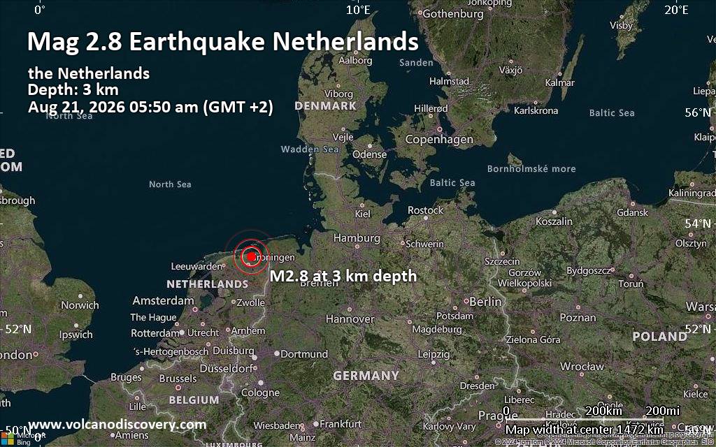
Small tremor of magnitude 2.8 just reported 20 km northeast of Groningen, Netherlands
|

#801720
Sun 08 Mar 2026 05:28:PM
|
Joined: Feb 2001
Posts: 678,976
Launch Director
|
OP

Launch Director
Joined: Feb 2001
Posts: 678,976 |
SPC Mar 8, 2026 1730 UTC Day 2 Convective OutlookSPC 1730Z Day 2 Outlook 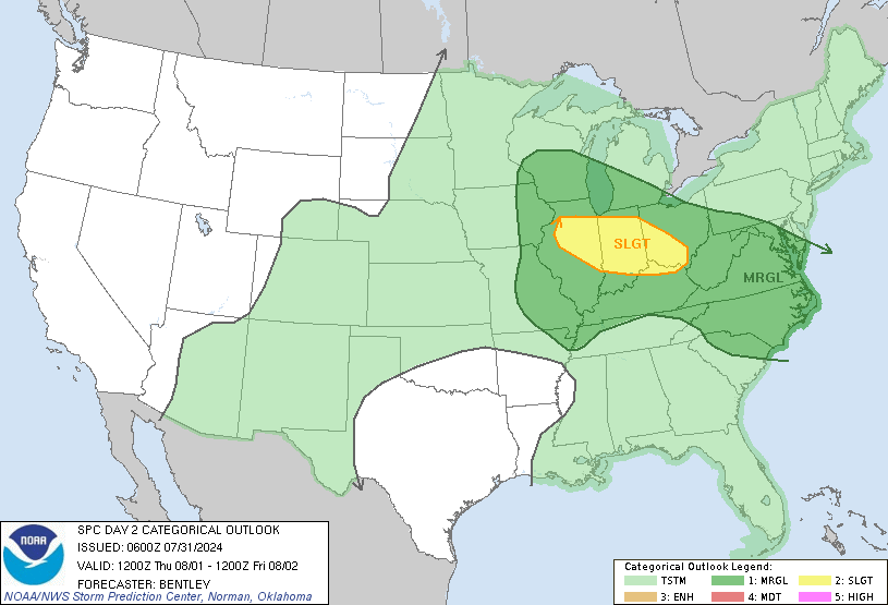
Day 2 Convective Outlook
NWS Storm Prediction Center Norman OK
1226 PM CDT Sun Mar 08 2026

Valid 091200Z - 101200Z

...THERE IS A SLIGHT RISK OF SEVERE THUNDERSTORMS ACROSS PARTS OF
THE LOWER MISSISSIPPI AND TENNESSEE VALLEYS...

...SUMMARY...
Severe thunderstorms are forecast on Monday across parts of the
lower Mississippi and Tennessee Valleys into the Southeast.

...Lower MS and TN Valleys into the Southeast...
A southern-stream, low-amplitude midlevel impulse and accompanying
40-kt speed max will advance eastward from the central Plains into
the TN Valley through the afternoon and evening. Steepened midlevel
lapse rates accompanying this feature will overspread a plume of
middle/upper 60s dewpoints, which combined with diurnal heating in
cloud breaks, will contribute to 1000-2000 J/kg MLCAPE (highest over
the Arklatex into the lower MS Valley).

Initial thunderstorms should develop within a zone of weak/broad
low-level warm advection preceding the midlevel impulse over the
Arklatex vicinity, before spreading/developing eastward through the
afternoon/evening. Around 40 kt of effective shear (with modestly
enhanced low-level hodograph curvature) and the aforementioned
buoyancy should support a mix of small organized clusters and
supercells -- both posing a risk of large hail and locally damaging
gusts. Any established semi-discrete supercells that evolve will be
capable of producing very large hail up to 2 inches in diameter, and
a tornado or two cannot be ruled out.

..Weinman.. 03/08/2026
Read morehttps://www.spc.noaa.gov/products/outlook/day2otlk_1730.html
|
|



CMS The Best Conveyancing solicitors conveyancing quotes throughout the UK
For any webhosting enquiries please email webmaster@aus-city.com
|
|
Forums60
Topics801,529
Posts836,321
Members2,960
| |
Most Online102,106
Jul 10th, 2026
|
|
|
|
|

|





































