|
|
|
0 members (),
1,711
guests, and
27
robots. |
|
Key:
Admin,
Global Mod,
Mod
|
|
S |
M |
T |
W |
T |
F |
S |
|
|
1
|
2
|
3
|
4
|
5
|
6
|
|
7
|
8
|
9
|
10
|
11
|
12
|
13
|
|
14
|
15
|
16
|
17
|
18
|
19
|
20
|
|
21
|
22
|
23
|
24
|
25
|
26
|
27
|
|
28
|
29
|
30
|
|
|
|
|
|
There are no members with birthdays on this day. |
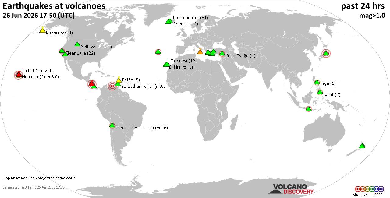
Volcano earthquake report for Friday, 26 Jun 2026
• Moderate mag. 4.7 earthquake - Indonesia: Northern Molucca Sea on Friday, J...
• World Earthquake Report for Friday, 26 June 2026
• Significant 5.0 quake hits near La Romana, Provincia de La Romana, Dominica...
• No Tsunami Threat After Magnitude 5.0 Earthquake Near Isla Mona
• Moderate mag. 4.9 earthquake - Caribbean Sea, Provincia de San Cristobal, 3...
|

#814346
Sun 31 May 2026 12:23:PM
|
Joined: Feb 2001
Posts: 678,976
Launch Director
|
OP

Launch Director
Joined: Feb 2001
Posts: 678,976 |
SPC May 31, 2026 1300 UTC Day 1 Convective OutlookSPC 1300Z Day 1 Outlook 
Day 1 Convective Outlook
NWS Storm Prediction Center Norman OK
0720 AM CDT Sun May 31 2026

Valid 311300Z - 011200Z

...THERE IS A SLIGHT RISK OF SEVERE THUNDERSTORMS THIS EVENING FROM
EASTERN KANSAS INTO WESTERN MISSOURI...

...SUMMARY...
A few severe storms are possible this evening from eastern Kansas
into western Missouri.

...KS/MO...
Moderately strong southwesterly flow aloft extends from the Four
Corners region into the Midwest today.  Water vapor imagery suggests
several weak shortwave troughs embedded in the flow to aid in
large-scale ascent and the potential for thunderstorm development
later today.  Thunderstorms are ongoing this morning over eastern
KS/western MO.  These storms will reinforce a surface boundary
across southeast KS/southwest MO.  The boundary will lift northward
this afternoon with the potential for isolated thunderstorms along
and south of it.  Very warm and humid conditions will prevail across
southeast KS/southern MO with MLCAPE values of 3000-4000 J/kg, along
with steep low and mid-level lapse rates.

While these early storms will pose an isolated severe threat, more
organized convection is forecast to form by early evening over
eastern KS and track along the boundary into MO.  Forecast soundings
suggest sufficient vertical shear to support supercells and bowing
structures capable of large hail and damaging winds, or even a
tornado.  A small area of SLGT risk has been added to address this
scenario.

...Elsewhere...
Widely scattered thunderstorms capable of damaging wind gusts and
hail will be possible this afternoon and early evening over parts of
AR, and southwest TX.  Isolated occurrences of large hail are also
possible today from parts of the Dakotas into NE/IA.

..Hart/Kerr.. 05/31/2026
Read morehttps://www.spc.noaa.gov/products/outlook/day1otlk_1300.html
|
|



CMS The Best Conveyancing solicitors conveyancing quotes throughout the UK
For any webhosting enquiries please email webmaster@aus-city.com
|
|
Forums60
Topics784,872
Posts819,639
Members2,960
| |
Most Online22,463
May 9th, 2026
|
|
|
|
|
Copyright 1996 - 2026 by David Cottle. Designed by David Bate Jr. All Rights Reserved.
By using this forum, the user agrees not to transfer any data or technical information received under this agreement to any other entity without the express approval of the AUS-CITY Forum Admins and/or authors of individual posts (Forum Admins and DoD/USSPACECOM for the analysis of satellite tracking data).
Two-line elements (TLE) and all other satellite data presented and distributed via this forum and AUS-CITY mailing lists are distributed with permission from DoD/USSTRATCOM.

|

|