|
1 members (Webmaster),
881
guests, and
46
robots. |
|
Key:
Admin,
Global Mod,
Mod
|
|
S |
M |
T |
W |
T |
F |
S |
|
|
|
|
|
|
|
1
|
|
2
|
3
|
4
|
5
|
6
|
7
|
8
|
|
9
|
10
|
11
|
12
|
13
|
14
|
15
|
|
16
|
17
|
18
|
19
|
20
|
21
|
22
|
|
23
|
24
|
25
|
26
|
27
|
28
|
29
|
|
30
|
31
|
|
|
|
|
|
|
There are no members with birthdays on this day. |
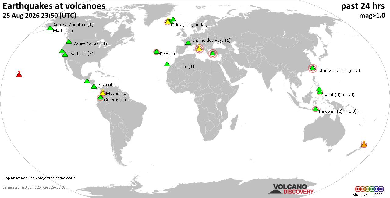
Volcano earthquake report for Tuesday, 25 Aug 2026
• Light mag. 3.9 earthquake - Myanmar (Burma): 85km NNW of Burma, Myanmar, on...
• World Earthquake Report for Tuesday, 25 August 2026
• Moderate mag. 4.0 earthquake - South OF Bali, Indonesia, on Wednesday, Aug ...
• Moderate mag. 4.7 earthquake - 77 km E of Tomioka, Japan, on Wednesday, Aug...
• Moderate mag. 4.2 earthquake - 192 km SSE of Sarangani, Philippines, on Wed...
|

#825922
Fri 17 Jul 2026 08:20:PM
|
Joined: Feb 2001
Posts: 678,977
Launch Director
|
|
Launch Director
Joined: Feb 2001
Posts: 678,977 |
Issued at 200 PM PDT Fri Jul 17 2026 535
WTPZ45 KNHC 172020
TCDEP5
Tropical Storm Elida Discussion Number 13
NWS National Hurricane Center Miami FL EP052026
200 PM PDT Fri Jul 17 2026
The latest ASCAT pass shows that the strongest winds are around 45
kt, while the most recent Dvorak fixes suggest the winds could be as
high as 55 kt. While there is no notable change in the structure of
Elida, with the convection being confined mostly to the east side,
the intensity for this advisory is being kept at 55 kt. This could
be a little generous, however. The ASCAT data also revealed that
the strongest winds are located in the northern side of the storm,
and tropical-force-winds extend about 170 n mi to the southeast.
Thus, Elida is still very asymmetric at this time.
Based on recent fixes, Elida's position has been shifted a bit
to the south of the previous track with a initial motion estimated
at 295/10 kt. A deep-layer trough remains entrenched off the west
coast of the United States, which should cause Elida to turn
northwestward and then north-northwestward by Sunday. The track
guidance continues to shift a bit more to the east, thus the
official NHC track forecast has again been nudged in that direction.
Elida has a very limited time to strengthen over warm waters and
in a low-shear environment. However, there is a possibility that
Elida can become a strong tropical storm. The peak intensity has
been brought down to 60 kt with this advisory again, since Elida
is running out of time to strengthen. This does keep the intensity
forecast in-line with the bulk of the guidance. Weakening should
being around 24 hours due to Elida moving over cooler waters and
into a region of increasing shear. Elida could lose organized deep
convection and become post-tropical around day 3.
FORECAST POSITIONS AND MAX WINDS
INIT 17/2100Z 17.1N 121.9W 55 KT 65 MPH
12H 18/0600Z 17.9N 122.9W 60 KT 70 MPH
24H 18/1800Z 19.4N 124.2W 60 KT 70 MPH
36H 19/0600Z 21.0N 125.4W 55 KT 65 MPH
48H 19/1800Z 22.9N 126.5W 50 KT 60 MPH
60H 20/0600Z 24.8N 127.3W 45 KT 50 MPH
72H 20/1800Z 26.9N 128.1W 40 KT 45 MPH...POST-TROPICAL
96H 21/1800Z 30.9N 129.6W 30 KT 35 MPH...POST-TROP/REMNT LOW
120H 22/1800Z 34.2N 131.4W 20 KT 25 MPH...POST-TROP/REMNT LOW
$$
Forecaster Katz/Cangialosi Source: Tropical Storm Elida Forecast Discussion Number 13
|
|



CMS The Best Conveyancing solicitors conveyancing quotes throughout the UK
For any webhosting enquiries please email webmaster@aus-city.com
|
|
Forums60
Topics801,787
Posts836,580
Members2,960
| |
Most Online102,106
Jul 10th, 2026
|
|
|





































