|
0 members (),
874
guests, and
37
robots. |
|
Key:
Admin,
Global Mod,
Mod
|
|
S |
M |
T |
W |
T |
F |
S |
|
|
|
|
|
|
|
1
|
|
2
|
3
|
4
|
5
|
6
|
7
|
8
|
|
9
|
10
|
11
|
12
|
13
|
14
|
15
|
|
16
|
17
|
18
|
19
|
20
|
21
|
22
|
|
23
|
24
|
25
|
26
|
27
|
28
|
29
|
|
30
|
31
|
|
|
|
|
|
|
There are no members with birthdays on this day. |
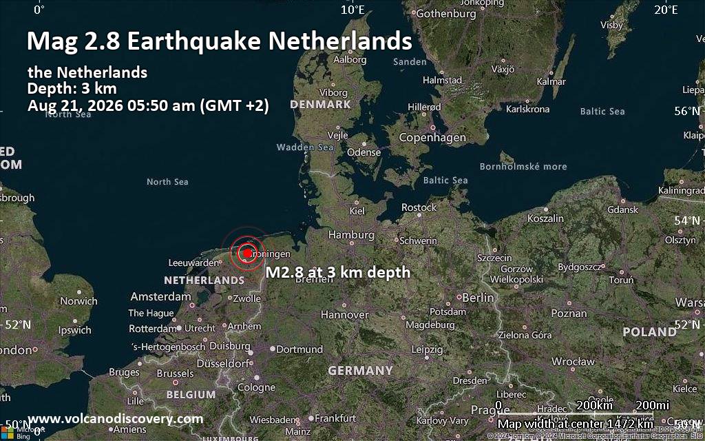
Small tremor of magnitude 2.8 just reported 20 km northeast of Groningen, Netherlands
|
|
|
Joined: Feb 2001
Posts: 678,976
Launch Director
|
OP

Launch Director
Joined: Feb 2001
Posts: 678,976 |
Eastern Pacific Tropical Weather Outlook


000
ABPZ20 KNHC 241149
TWOEP
Tropical Weather Outlook
NWS National Hurricane Center Miami FL
500 AM PDT Mon Aug 24 2026
For the eastern and central North Pacific east of 180 longitude:
Active Systems:
The National Hurricane Center is issuing advisories on Tropical
Storm Lala, located several hundred miles north of Pearl and Hermes
Atoll, on Tropical Depression Moke, located several hundred miles
south of Honolulu, Hawaii, and on Tropical Storm Iselle, located
several hundred miles southwest of the southern tip of the Baja
California Peninsula.
Well Southwest of the Baja California Peninsula (EP91):
Satellite wind data indicate that the small area of low pressure
located well to the southwest of the southern tip of the Baja
California Peninsula has become a little better defined. However,
the shower and thunderstorm activity remains disorganized.
Environmental conditions could still support the development of a
short-lived tropical depression during the next day or so while the
system moves generally northward, before it becomes absorbed by
Tropical Storm Iselle.
* Formation chance through 48 hours...medium...50 percent.
* Formation chance through 7 days...medium...50 percent.
Central East Pacific:
An area of low pressure is expected to develop well south of the
southern tip of the Baja California Peninsula in a day or two.
Environmental conditions are forecast to be favorable for
development thereafter, and a tropical depression is expected to
form by the end of this week while the system moves generally
west-northwestward at 10 to 15 mph.
* Formation chance through 48 hours...low...near 0 percent.
* Formation chance through 7 days...high...80 percent.
Well Offshore of Southern Mexico:
Another area of low pressure could form well offshore of Central
America late this week. Environmental conditions appear conducive
for some gradual development of this system over the weekend while
it moves westward to west-northwestward at 10 to 15 mph well
offshore of southern Mexico.
* Formation chance through 48 hours...low...near 0 percent.
* Formation chance through 7 days...low...30 percent.
Western East Pacific:
A broad area of low pressure is forecast to form well to the
east-southeast of the Hawaiian Islands during the middle part of the
week. Some slow development of this system is possible later this
week while it moves northeastward or northward across the western
portion of the East Pacific.
* Formation chance through 48 hours...low...near 0 percent.
* Formation chance through 7 days...low...20 percent.
&&
Public Advisories on Tropical Storm Iselle are issued under WMO
header WTPZ34 NHC and under AWIPS header MIATCPEP4.
Forecast/Advisories on Tropical Storm Iselle are issued under WMO
header WTPZ24 and under AWIPS header MIATCMEP4.
$$
Forecaster Hagen
|
|



CMS The Best Conveyancing solicitors conveyancing quotes throughout the UK
For any webhosting enquiries please email webmaster@aus-city.com
|
|
Forums60
Topics801,011
Posts835,802
Members2,960
| |
Most Online102,106
Jul 10th, 2026
|
|
|





































