|
0 members (),
764
guests, and
36
robots. |
|
Key:
Admin,
Global Mod,
Mod
|
|
S |
M |
T |
W |
T |
F |
S |
|
|
|
|
|
|
|
1
|
|
2
|
3
|
4
|
5
|
6
|
7
|
8
|
|
9
|
10
|
11
|
12
|
13
|
14
|
15
|
|
16
|
17
|
18
|
19
|
20
|
21
|
22
|
|
23
|
24
|
25
|
26
|
27
|
28
|
29
|
|
30
|
31
|
|
|
|
|
|
|
There are no members with birthdays on this day. |
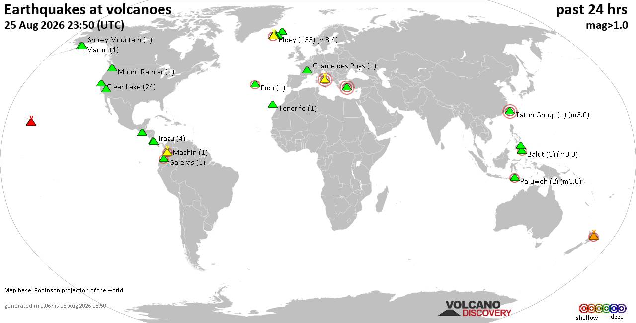
Volcano earthquake report for Tuesday, 25 Aug 2026
• Light mag. 3.9 earthquake - Myanmar (Burma): 85km NNW of Burma, Myanmar, on...
• World Earthquake Report for Tuesday, 25 August 2026
• Moderate mag. 4.0 earthquake - South OF Bali, Indonesia, on Wednesday, Aug ...
• Moderate mag. 4.7 earthquake - 77 km E of Tomioka, Japan, on Wednesday, Aug...
• Moderate mag. 4.2 earthquake - 192 km SSE of Sarangani, Philippines, on Wed...
|
|
|
Joined: Feb 2001
Posts: 678,977
Launch Director
|
|
Launch Director
Joined: Feb 2001
Posts: 678,977 |
SPC Day 2 Fire Weather OutlookSPC Day 2 Fire Weather Outlook 
Day 2 Fire Weather Outlook
NWS Storm Prediction Center Norman OK
0214 PM CDT Tue Aug 25 2026

Valid 261200Z - 271200Z

The Isolated Dry Thunderstorm risk was expanded slightly eastward to
include more of western Montana based on the latest guidance.
HREF/REFS depict 50-60% probabilities of thunderstorms across
southwest Montana into the Yellowstone Country on Day 2/Wednesday.
Forecast soundings depict a dry sub-cloud layer, sufficient
instability, and 20-30 kt LCL-EL winds indicating limited
precipitation efficiency. A recently receptive fuelscape with active
fires within the higher terrain warrant an expansion of dry
thunderstorm highlights where lightning ignitions are possible. The
rest of the forecast remains on track, see the previous discussion
for more information.

..Elizalde-Garcia.. 08/25/2026

.PREV DISCUSSION... /ISSUED 0102 AM CDT Tue Aug 25 2026/

...Synopsis...
An upper-level trough impinging upon the Pacific Northwest will
usher in increasing southwesterly flow and dry conditions to
portions of the interior Northwest and northern Great Basin. The
trough and afternoon destabilization will also bring a dry
thunderstorm threat to the portions of the northern Rockies
Wednesday afternoon. Farther south, an offshore pressure gradient
becomes established this evening and overnight hours leading to fire
weather concerns across portions of southern CA.

...Northern Rockies into northern Washington...
The upper-level trough nearing the Pacific Northwest will boost
southwest flow aloft while residual monsoon moisture lingers across
the northern Rockies. Daytime instability over complex topography in
addition to diffuse forcing for ascent will likely bring a broad
area of isolated high-based showers and thunderstorms to the
northern Rockies in western MT and northern ID as well as across
northern WA. PWAT values will generally be below 0.80" while a dry,
sub-cloud boundary layer and high surface dew point depressions
inhibit rainfall accumulations. Fuels remain receptive with new
ignitions possible Wednesday afternoon from this thunderstorm
activity.

...Columbia Basin southward towards the northern Great Basin and
Northeastern California...
Increasingly dry southwest flow as deeper monsoon moisture pushes
eastward is expected to bring elevated fire weather concerns to much
of the Interior Northwest and northern Sierra Nevada Wednesday. An
evolving well-mixed and dry boundary layer by peak afternoon heating
will support enhanced southwest winds at the surface of around 15
mph. These winds coupled with RH as low as 10 percent amid dry fuels
will promote elevated fire weather conditions across the region. A
locally critical fire weather concern may emerge across northeastern
CA into southeastern OR where sustained southwest winds of 20 mph
may occur at times.

...Southern California...
A multi-day elevated fire weather threat will continue for portions
of southern CA late Wednesday into early Thursday morning as
offshore/sundowner winds develop with supportive surface high
pressure across the Great Basin. Offshore winds of 15-25 mph are
expected in favored terrain and downslope regions as RH falls to as
low as 15 percent beginning Wednesday evening into early Thursday
morning. Elevated highlights were introduced into portions of
LA/Ventura/Santa Barbara counties.

...Please see www.spc.noaa.gov/fire for graphic product...
Read morehttps://www.spc.noaa.gov/products/fire_wx/fwdy2.html
|
|



CMS The Best Conveyancing solicitors conveyancing quotes throughout the UK
For any webhosting enquiries please email webmaster@aus-city.com
|
|
Forums60
Topics801,772
Posts836,565
Members2,960
| |
Most Online102,106
Jul 10th, 2026
|
|
|





































