|
|
|
0 members (),
3,845
guests, and
26
robots. |
|
Key:
Admin,
Global Mod,
Mod
|
|
S |
M |
T |
W |
T |
F |
S |
|
|
|
1
|
2
|
3
|
4
|
5
|
|
6
|
7
|
8
|
9
|
10
|
11
|
12
|
|
13
|
14
|
15
|
16
|
17
|
18
|
19
|
|
20
|
21
|
22
|
23
|
24
|
25
|
26
|
|
27
|
28
|
29
|
30
|
|
|
|
|
There are no members with birthdays on this day. |
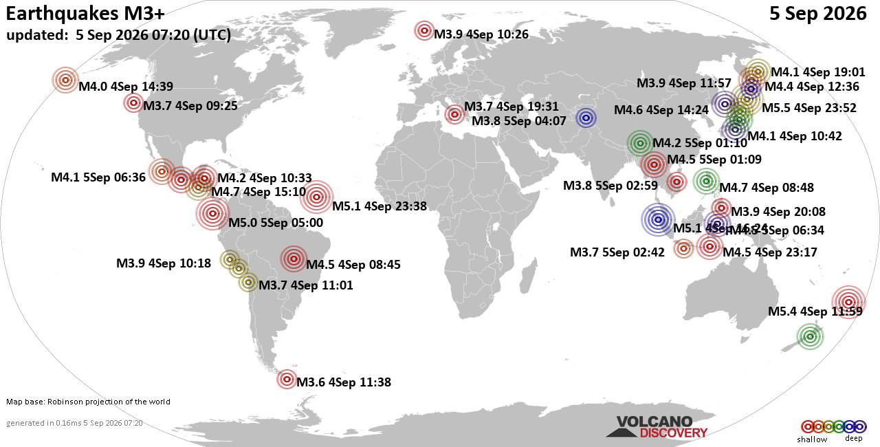
World Earthquake Report for Saturday, 5 September 2026
• Moderate mag. 4.0 earthquake - Provincia de Iquique, Tarapacá, Chile, on S...
• Volcano earthquake report for Saturday, 5 September 2026
• Moderate magnitude 4.6 earthquake 77 km southeast of Gorontalo, Indonesia
• Moderate mag. 4.1 earthquake - North Pacific Ocean, 152 km west of Manzanil...
• Moderate mag. 4.5 earthquake - Sulawesi Tengah, 77 km south of Gorontalo, K...
|
|
|
Joined: Feb 2001
Posts: 678,977
Launch Director
|
|
Launch Director
Joined: Feb 2001
Posts: 678,977 |
SPC Sep 5, 2026 0730 UTC Day 3 Severe Thunderstorm OutlookSPC 0730Z Day 3 Outlook 
Day 3 Convective Outlook
NWS Storm Prediction Center Norman OK
0137 AM CDT Sat Sep 05 2026

Valid 071200Z - 081200Z

...THERE IS A MARGINAL RISK OF SEVERE THUNDERSTORMS ACROSS PARTS OF
THE NORTHERN AND CENTRAL PLAINS INTO WESTERN MINNESOTA...

...SUMMARY...
Strong to severe thunderstorms are possible across portions of the
northern and central Plains into Minnesota on Monday.

...Nebraska into the Dakotas and Minnesota...

An upper shortwave trough will eject east/northeast from the
Intermountain West to the northern Plains on Monday. Strong
mid/upper southwesterly flow will overspread the region ahead of the
trough. At the surface, a low over eastern MT will develop northeast
into the Canadian Prairies, and a trailing cold front will push east
across portions of NE/SD/ND. A moist airmass will be in place ahead
of the front, promoting areas of moderate instability. Vertically
veering wind profiles, and strengthening midlevel southwesterly
flow, will generate effective shear magnitudes greater than 35 kt,
supporting organized thunderstorms. While cooling aloft will result
in modestly steep lapse rates, warmer temperatures may linger around
850 mb, leading to capping concerns. Nevertheless, even elevated
storms will pose a risk for hail, and depending on storm mode,
strong wind gusts.

..Leitman.. 09/05/2026
Read morehttps://www.spc.noaa.gov/products/outlook/day3otlk_0730.html
|
|



CMS The Best Conveyancing solicitors conveyancing quotes throughout the UK
For any webhosting enquiries please email webmaster@aus-city.com
|
|
Forums60
Topics820,088
Posts854,881
Members2,960
| |
Most Online102,106
Jul 10th, 2026
|
|
|
|
|

|





































