|
|
|
0 members (),
764
guests, and
36
robots. |
|
Key:
Admin,
Global Mod,
Mod
|
|
S |
M |
T |
W |
T |
F |
S |
|
|
|
|
|
|
|
1
|
|
2
|
3
|
4
|
5
|
6
|
7
|
8
|
|
9
|
10
|
11
|
12
|
13
|
14
|
15
|
|
16
|
17
|
18
|
19
|
20
|
21
|
22
|
|
23
|
24
|
25
|
26
|
27
|
28
|
29
|
|
30
|
31
|
|
|
|
|
|
|
There are no members with birthdays on this day. |
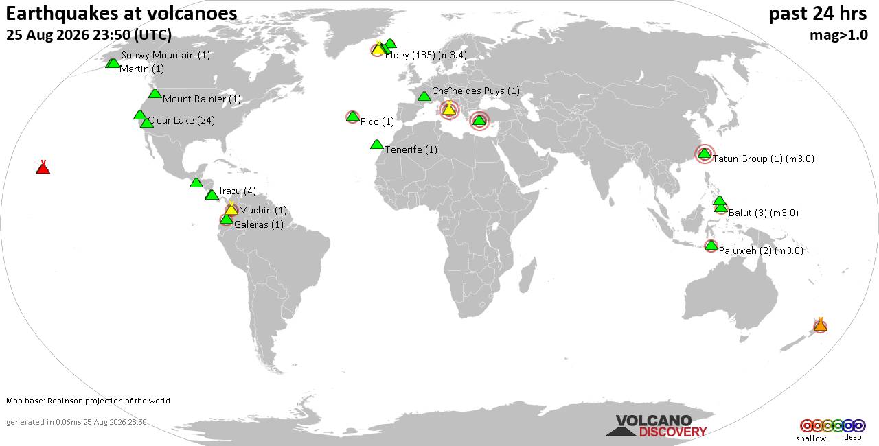
Volcano earthquake report for Tuesday, 25 Aug 2026
• Light mag. 3.9 earthquake - Myanmar (Burma): 85km NNW of Burma, Myanmar, on...
• World Earthquake Report for Tuesday, 25 August 2026
• Moderate mag. 4.0 earthquake - South OF Bali, Indonesia, on Wednesday, Aug ...
• Moderate mag. 4.7 earthquake - 77 km E of Tomioka, Japan, on Wednesday, Aug...
• Moderate mag. 4.2 earthquake - 192 km SSE of Sarangani, Philippines, on Wed...
|
|
|
Joined: Feb 2001
Posts: 678,977
Launch Director
|
|
Launch Director
Joined: Feb 2001
Posts: 678,977 |
SPC Aug 25, 2026 1930 UTC Day 3 Severe Thunderstorm OutlookSPC 1930Z Day 3 Outlook 
Day 3 Convective Outlook
NWS Storm Prediction Center Norman OK
0213 PM CDT Tue Aug 25 2026

Valid 271200Z - 281200Z

...THERE IS A SLIGHT RISK OF SEVERE THUNDERSTORMS ACROSS PARTS OF
THE NORTHEAST...

...SUMMARY...
Scattered strong to severe thunderstorms are possible across parts
of the Northeast on Thursday. Damaging wind, hail and a tornado or
two may accompany these storms.

...Ohio Valley into the Northeast...

Modestly enhanced southwesterly flow will overspread the region to
the east of the upper trough axis oriented from the Great Lakes to
TN Valley on Thursday. At the surface, a front will develop
east/southeast across the Ohio Valley and Lower Great Lakes through
the period. Southerly low-level flow ahead of the surface boundary
will maintain 60s F dewpoints, supporting weak to moderate
destabilization from the Upper Ohio Valley toward the Hudson Valley
(decreasing across New England). Scattered thunderstorm development
is expected during the afternoon and continuing through the evening.
Forecast soundings suggest supercells will be possible, with an
accompanying risk of damaging winds, hail, and possibly a tornado or
two where backed low-level winds persist.

Scattered thunderstorm clusters are expected with southwest extent
into southern OH/eastern KY/WV/VA as several shortwave impulses/MCVs
migrate through southwesterly flow from the southern to central
Appalachians. Vertical shear will be weaker further south, but a
moist and unstable airmass could support strong wet microbursts.

...Central High Plains...

The amplified upper ridge will develop eastward toward the High
Plains on Thursday. Low-level moisture will be more limited across
eastern CO/NM and vicinity. However, southeasterly low-level flow
near a surface boundary will maintain upper 50s to low 60s F
dewpoints across portions of NE toward the Black Hills in SD.
Isolated storms are expected to develop over the Black Hills and
within the low-level warm advection regime with southeast extent
into NE. Supercell wind profiles suggest strong outflow winds and
large hail (some possibly 2+ inch diameter) will be possible. Storm
coverage with southward extent is uncertain, but will maintain the
Marginal (level 1 of 5) risk for now given a conditionally
supportive environment.

..Leitman.. 08/25/2026
Read morehttps://www.spc.noaa.gov/products/outlook/day3otlk_1930.html
|
|



CMS The Best Conveyancing solicitors conveyancing quotes throughout the UK
For any webhosting enquiries please email webmaster@aus-city.com
|
|
Entire Thread
|

 SPC Aug 25, 2026 1930 UTC Day 3 Severe Thunderstorm Outlook
|
Webmaster
|
Yesterday at 07:14 PM
|
|
Forums60
Topics801,772
Posts836,565
Members2,960
| |
Most Online102,106
Jul 10th, 2026
|
|
|
|
|

|





































