|
|
|
0 members (),
620
guests, and
32
robots. |
|
Key:
Admin,
Global Mod,
Mod
|
|
S |
M |
T |
W |
T |
F |
S |
|
1
|
2
|
3
|
4
|
5
|
6
|
7
|
|
8
|
9
|
10
|
11
|
12
|
13
|
14
|
|
15
|
16
|
17
|
18
|
19
|
20
|
21
|
|
22
|
23
|
24
|
25
|
26
|
27
|
28
|
|
29
|
30
|
|
|
|
|
|
|
There are no members with birthdays on this day. |

#729487
Tue 16 Jul 2024 07:41:PM
|
Joined: Feb 2001
Posts: 381,903
Launch Director
|
OP

Launch Director
Joined: Feb 2001
Posts: 381,903 |
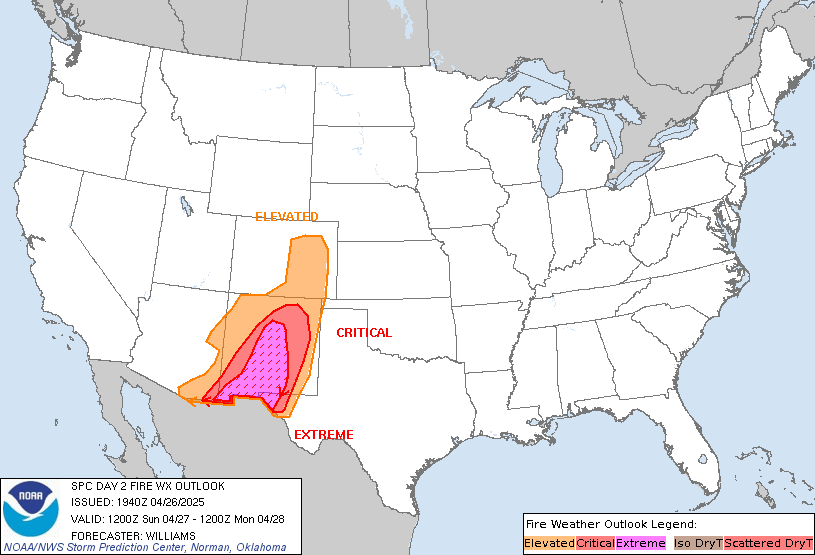
SPC Day 2 Fire Weather OutlookSPC Day 2 Fire Weather Outlook 
Day 2 Fire Weather Outlook
NWS Storm Prediction Center Norman OK
0240 PM CDT Tue Jul 16 2024

Valid 171200Z - 181200Z

No changes are needed to the D2 Fire Weather Outlook. See previous
discussion below.

..Thornton.. 07/16/2024

.PREV DISCUSSION... /ISSUED 0134 AM CDT Tue Jul 16 2024/

...Synopsis...
Dry thunderstorms will continue to pose a fire weather threat on
Wednesday across parts of the Pacific Northwest and Great Basin.
Monsoonal moisture continues to stream north into the northern Great
Basin/Pacific Northwest, on the northwestern periphery of a Four
Corners upper ridge per recent advected PWAT imagery. A weak
upper-level impulse (evident in early-morning water-vapor imagery
off the CA coast) will translate across the Pacific Northwest
through the day Wednesday, providing sufficient lift for
thunderstorm development. Deep boundary-layer mixing through roughly
3 km is anticipated across much of the Great Basin and Pacific
Northwest. Such dry conditions will limit rainfall totals at the
surface and support dry lightning potential. Recent fuel analyses
and fire activity indicate that driest fuels are likely found across
the Pacific Northwest where there has been negligible rainfall over
the past 7 days. Further southeast into the Great Basin, pockets of
wetting rainfall may have limited the spatial extent of viable fuels
to some degree, but most locations have likely retained burnable
fuels. Consequently, dry thunderstorms should pose a fire weather
concern for both regions.

...Please see www.spc.noaa.gov/fire for graphic product...
Read morehttps://www.spc.noaa.gov/products/fire_wx/fwdy2.html
|
|


CMS The Best Conveyancing solicitors conveyancing quotes throughout the UK
For any webhosting enquiries please email webmaster@aus-city.com
|
|
Forums60
Topics698,396
Posts733,010
Members2,957
| |
Most Online4,158
Jun 21st, 2024
|
|
|
|
|
Copyright 1996 - 2024 by David Cottle. Designed by David Bate Jr. All Rights Reserved.
By using this forum, the user agrees not to transfer any data or technical information received under the agreement, to any other entity without the express approval of the AUS-CITY Forum Admins and/or authors of individual posts (Forum Admins and DoD/USSPACECOM for the analysis of satellite tracking data).
Two-line elements (TLE) and all other satellite data presented and distributed via this forum and e-mail lists of AUS-CITY are distributed with permission from DoD/USSTRATCOM.


Reprise Hosting


|

|