|
0 members (),
4,056
guests, and
25
robots. |
|
Key:
Admin,
Global Mod,
Mod
|
|
S |
M |
T |
W |
T |
F |
S |
|
|
|
1
|
2
|
3
|
4
|
5
|
|
6
|
7
|
8
|
9
|
10
|
11
|
12
|
|
13
|
14
|
15
|
16
|
17
|
18
|
19
|
|
20
|
21
|
22
|
23
|
24
|
25
|
26
|
|
27
|
28
|
29
|
30
|
|
|
|
|
There are no members with birthdays on this day. |
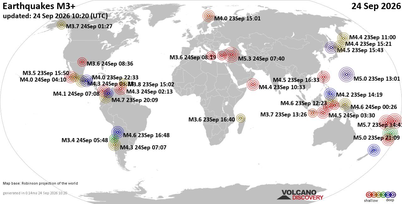
World Earthquake Report for Thursday, 24 September 2026
• Moderate mag. 4.3 earthquake - Madagascar: Mozambique Channel on Thursday, ...
• Small magnitude 3.9 earthquake hits near Hastings, Hastings District, Hawke...
• Volcano earthquake report for Thursday, 24 September 2026
• Light mag. 3.9 earthquake - South Pacific Ocean, 10.2 km south of Hastings,...
• Moderate magnitude 4.1 quake hits 31 miles southeast of Midland, Texas, Uni...
|

#747638
Mon 16 Dec 2024 09:42:PM
|
Joined: Feb 2001
Posts: 678,977
Launch Director
|
|
Launch Director
Joined: Feb 2001
Posts: 678,977 |
SPC Day 3-8 Fire Weather OutlookSPC Day 3-8 Fire Weather Outlook 
Day 3-8 Fire Weather Outlook
NWS Storm Prediction Center Norman OK
0337 PM CST Mon Dec 16 2024

Valid 181200Z - 241200Z

The upper-level pattern will be characterized by amplified ridging
in the West with broad troughing in the East. Shortwave troughs are
expected to progress through parts of the central and eastern U.S.
through the rest of this week. Model guidance suggests the western
ridge will break down this weekend into early next week. With the
more progressive pattern east of the Divide, surface high pressure
and colder air is expected to filter into the these areas. Fire
weather concerns for most areas will be minimal. Some areas of
stronger downslope winds are possible in the central High Plains
vicinity as the shortwave troughs move through. Given the colder
temperatures, it is not clear how much fire weather concern will
develop, but fuels in that region remain dry enough to support
increased risk at least on a localized basis.

Moderately strong high pressure in the Great Basin will drive
offshore winds across parts of southern California. Upper-level wind
support will be notably lacking for this event. How low RH will be,
especially on Wednesday morning, is also uncertain. With winds
through the typical Santa Ana corridors peaking Wednesday morning,
the current thinking is that there will be a few hours of critical
fire weather as RH begins decrease with daytime heating. Winds are
expected to diminish during the afternoon/evening.

..Wendt.. 12/16/2024

...Please see www.spc.noaa.gov/fire for graphic product...
Read morehttps://www.spc.noaa.gov/products/exper/fire_wx/
|
|



CMS The Best Conveyancing solicitors conveyancing quotes throughout the UK
For any webhosting enquiries please email webmaster@aus-city.com
|
|
Forums60
Topics840,452
Posts875,247
Members2,960
| |
Most Online102,106
Jul 10th, 2026
|
|
|





































