|
|
|
0 members (),
2,222
guests, and
23
robots. |
|
Key:
Admin,
Global Mod,
Mod
|
|
S |
M |
T |
W |
T |
F |
S |
|
1
|
2
|
3
|
4
|
5
|
6
|
7
|
|
8
|
9
|
10
|
11
|
12
|
13
|
14
|
|
15
|
16
|
17
|
18
|
19
|
20
|
21
|
|
22
|
23
|
24
|
25
|
26
|
27
|
28
|
|
There are no members with birthdays on this day. |

#781153
Fri 31 Oct 2025 07:30:PM
|
Joined: Feb 2001
Posts: 381,904
Launch Director
|
OP

Launch Director
Joined: Feb 2001
Posts: 381,904 |
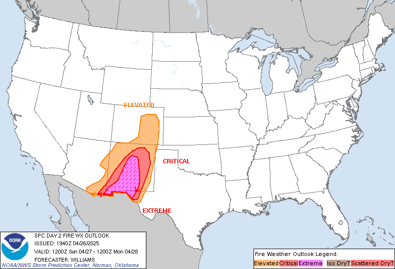
SPC Day 2 Fire Weather OutlookSPC Day 2 Fire Weather Outlook 
Day 2 Fire Weather Outlook
NWS Storm Prediction Center Norman OK
0229 PM CDT Fri Oct 31 2025

Valid 011200Z - 021200Z

...NO CRITICAL AREAS...

No changes to the previous Day 2 Outlook. Surface high pressure
across much of the eastern U.S. promoting light surface winds and
cooler temperatures, along with cloud cover and marginal fuel
dryness, will mitigate fire weather concerns for much of the region.
Warm and very dry conditions under an upper-level ridge are expected
within the Intermountain West and Southwest but light winds will
limit the overall fire weather threat.

..Williams.. 10/31/2025

.PREV DISCUSSION... /ISSUED 0152 AM CDT Fri Oct 31 2025/

...Synopsis...
An upper trough will continue to deepen over the eastern U.S. while
upper ridging persists west of the Rockies tomorrow (Saturday).
Beneath this upper pattern, surface high pressure will prevail over
much of the central and southern U.S., promoting relatively cool and
calm low-level conditions and limiting wildfire spread potential.

...Please see www.spc.noaa.gov/fire for graphic product...
Read morehttps://www.spc.noaa.gov/products/fire_wx/fwdy2.html
|
|


CMS The Best Conveyancing solicitors conveyancing quotes throughout the UK
For any webhosting enquiries please email webmaster@aus-city.com
|
|
Forums60
Topics762,137
Posts796,866
Members2,957
| |
Most Online17,963
Jan 15th, 2026
|
|
|
|
|
Copyright 1996 - 2026 by David Cottle. Designed by David Bate Jr. All Rights Reserved.
By using this forum, the user agrees not to transfer any data or technical information received under the agreement, to any other entity without the express approval of the AUS-CITY Forum Admins and/or authors of individual posts (Forum Admins and DoD/USSPACECOM for the analysis of satellite tracking data).
Two-line elements (TLE) and all other satellite data presented and distributed via this forum and e-mail lists of AUS-CITY are distributed with permission from DoD/USSTRATCOM.


Reprise Hosting


|

|