|
0 members (),
764
guests, and
36
robots. |
|
Key:
Admin,
Global Mod,
Mod
|
|
S |
M |
T |
W |
T |
F |
S |
|
|
|
|
|
|
|
1
|
|
2
|
3
|
4
|
5
|
6
|
7
|
8
|
|
9
|
10
|
11
|
12
|
13
|
14
|
15
|
|
16
|
17
|
18
|
19
|
20
|
21
|
22
|
|
23
|
24
|
25
|
26
|
27
|
28
|
29
|
|
30
|
31
|
|
|
|
|
|
|
There are no members with birthdays on this day. |
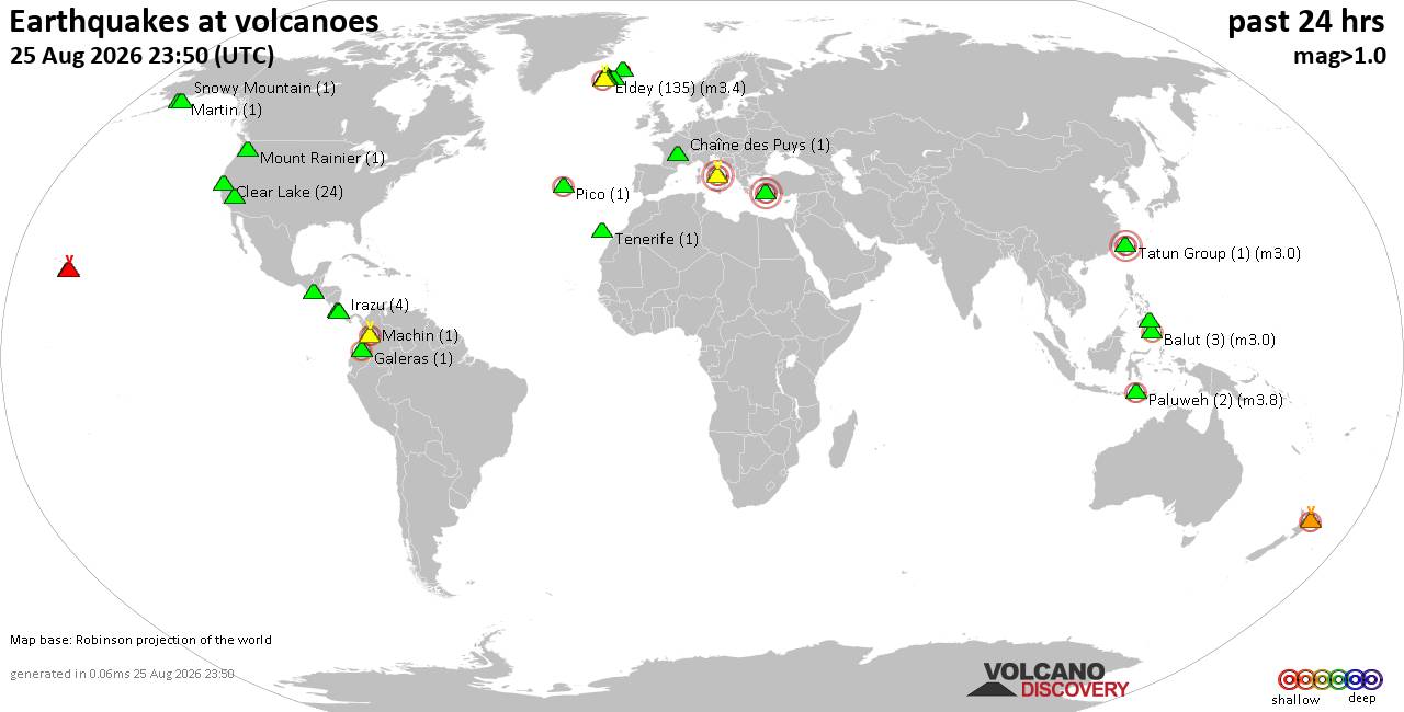
Volcano earthquake report for Tuesday, 25 Aug 2026
• Light mag. 3.9 earthquake - Myanmar (Burma): 85km NNW of Burma, Myanmar, on...
• World Earthquake Report for Tuesday, 25 August 2026
• Moderate mag. 4.0 earthquake - South OF Bali, Indonesia, on Wednesday, Aug ...
• Moderate mag. 4.7 earthquake - 77 km E of Tomioka, Japan, on Wednesday, Aug...
• Moderate mag. 4.2 earthquake - 192 km SSE of Sarangani, Philippines, on Wed...
|
|
|
Joined: Feb 2001
Posts: 678,977
Launch Director
|
|
Launch Director
Joined: Feb 2001
Posts: 678,977 |
SPC Aug 25, 2026 2000 UTC Day 1 Convective OutlookSPC 2000Z Day 1 Outlook 
Day 1 Convective Outlook
NWS Storm Prediction Center Norman OK
0255 PM CDT Tue Aug 25 2026

Valid 252000Z - 261200Z

...THERE IS AN ENHANCED RISK OF SEVERE THUNDERSTORMS FOR THE TEXAS
PANHANDLE...

...THERE IS A SLIGHT RISK OF SEVERE THUNDERSTORMS FOR EASTERN
MINNESOTA INTO NORTHWEST WISCONSIN AND PORTIONS OF THE CENTRAL AND
SOUTHERN HIGH PLAINS...

...SUMMARY...
Scattered severe thunderstorms are likely across parts of the
central/southern Plains this afternoon and evening, and also
possible across portions of the Upper Midwest. Severe wind gusts and
large hail are the primary hazards.

...20z Update...

...Central High Plains...
The 15% wind/hail probability areas (and the corresponding Level
2/Slight Risk area) were shifted westward with this outlook update
based on the latest HRRR/RRFS and time-lagged ensemble guidance that
suggest greater storm coverage is more likely from the southern
Nebraska Panhandle into northeastern Colorado, southwestern
Nebraska, and northwestern Kansas. The eastern extent of these
probabilities was also trimmed across portions of south-central
Nebraska and north-central Kansas where recent guidance is more
suggestive of lower storm coverage.

Elsewhere, the forecast remains generally on track with only minor
changes made to the existing outlook. See the discussion below and
MCD 2127 for additional details.

..Chalmers/Thornton.. 08/25/2026

.PREV DISCUSSION... /ISSUED 1130 AM CDT Tue Aug 25 2026/

...Central/Southern Plains...
A prominent mid-level anticyclone will remain centered over NM with
a couple of weak disturbances cresting the ridge.  A lead vorticity
max associated with morning showers/thunderstorms over western KS
will continue slowly east-southeastward while an upstream
disturbance over central CO moves into the central High Plains by
late afternoon.  In the low levels, a cold front extending
southwestward from the Upper Midwest into the central High Plains
will undergo frontolysis across the central High Plains.  Farther
south, a stationary boundary sagging southward to near I-40 in the
TX Panhandle will extend east-northeast into north-central OK.
North of the TX-OK boundary, a moisture plume with slightly richer
low-level moisture analyzed this morning protrudes westward from
north-central OK into the High Plains.

Weak ascent associated with the disturbance moving into the High
Plains later this afternoon combined with very strong heating will
favor isolated to widely scattered initial storm development over
the High Plains, particularly near the Raton Mesa where upslope flow
is expected.  Models generally show moderate buoyancy developing by
mid afternoon with the stronger mid to high-level flow across
western NE and decreasing with south extent.  Supercells will be
favored initially over parts of western NE with an attendant hail
risk and with some clustering possible during the evening
(severe-wind hazard).  Farther south, have upgraded to 30-percent
wind probabilities due primarily to increased confidence in a
focused severe-wind threat forecast across the TX Panhandle late
this afternoon through the evening.  There is seemingly large model
agreement/notable consistency in 00z and 12z AI and CAM ensembles,
and time-lagged CAM explicit wind guidance and depictions of a
linear mode within a very well mixed boundary layer which will be
favorable for severe gusts (60-85 mph).

...Eastern Minnesota/Western Wisconsin/Western Upper Michigan...
A mid-level shortwave trough (and related mid/high-level westerly
jet) will dig southeastward from southern Manitoba toward northern
MN and Lake Superior through the period.  An adequately moist and
destabilizing airmass will develop immediately ahead of an
eastward-advancing cold front by mid/late afternoon.  Models show a
narrow zone of around 1000-2000 J/kg MLCAPE across the eastern half
of MN/far northwest WI ahead of the front by late afternoon.  Some
supercells will be possible initially, aside from more prevalent
multicells/clusters.  Large hail and damaging winds are expected to
be the primary hazards before storms gradually weaken during the
evening.

...Southeast...
While mid-level flow and related deep-layer shear are expected to
remain weak, a moist and moderately unstable airmass will exist
along/south of a stalled front across the Southeast today.  As
low-level lapse rates gradually steepen through the afternoon,
isolated pulse-type thunderstorms capable of producing water-loaded
downdrafts and perhaps localized wind damage via 50-60 mph gusts.
See MCD #2125 for short-term details regarding a potential isolated
wind damage threat developing early this afternoon.
Read morehttps://www.spc.noaa.gov/products/outlook/day1otlk_2000.html
|
|



CMS The Best Conveyancing solicitors conveyancing quotes throughout the UK
For any webhosting enquiries please email webmaster@aus-city.com
|
|
Forums60
Topics801,772
Posts836,565
Members2,960
| |
Most Online102,106
Jul 10th, 2026
|
|
|





































