|
0 members (),
927
guests, and
27
robots. |
|
Key:
Admin,
Global Mod,
Mod
|
|
S |
M |
T |
W |
T |
F |
S |
|
|
|
|
|
|
|
1
|
|
2
|
3
|
4
|
5
|
6
|
7
|
8
|
|
9
|
10
|
11
|
12
|
13
|
14
|
15
|
|
16
|
17
|
18
|
19
|
20
|
21
|
22
|
|
23
|
24
|
25
|
26
|
27
|
28
|
29
|
|
30
|
31
|
|
|
|
|
|
|
There are no members with birthdays on this day. |
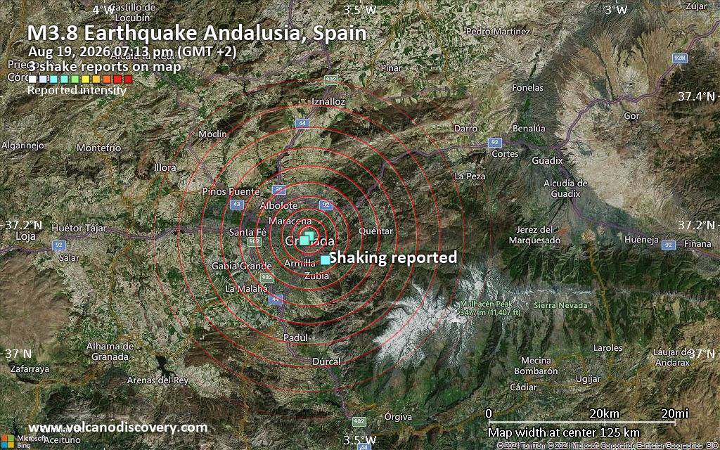
Seismic-like event, possible earthquake, reported few minutes ago near Granada, Andalusia, Spain
• Volcano earthquake report for Wednesday, 19 Aug 2026
• Moderate magnitude 4.8 earthquake 81 km north of Sanchez-Mira, Philippines
• Moderate mag. 4.0 earthquake - North Pacific Ocean, 30 km southeast of Peta...
• Moderate mag. 4.8 earthquake - South China Sea, 36 km west of Calayan Islan...
• World Earthquake Report for Wednesday, 19 August 2026
|
|
|
Joined: Feb 2001
Posts: 678,976
Launch Director
|
OP

Launch Director
Joined: Feb 2001
Posts: 678,976 |
SPC MD 2043MD 2043 CONCERNING SEVERE POTENTIAL...WATCH POSSIBLE FOR PARTS OF EAST CENTRAL AND SOUTHEASTERN ARIZONA 
Mesoscale Discussion 2043
NWS Storm Prediction Center Norman OK
0308 PM CDT Wed Aug 19 2026

Areas affected...parts of east central and southeastern Arizona

Concerning...Severe potential...Watch possible

Valid 192008Z - 192245Z

Probability of Watch Issuance...40 percent

SUMMARY...Thunderstorm activity will continue to slowly increase and
spread westward off the higher terrain through 2-4 PM MST.  A severe
weather watch may be needed at some point, once storms begin to
consolidate into an evolving cluster, but this may not be until
later this evening.

DISCUSSION...Substantive destabilization is ongoing across much of
central and southern Arizona, within a seasonably moist air mass
boosted by a recent surge from the Gulf of California.  Latest
objective analysis indicates that strongest potential instability
has become focused to immediate southwest and west of the higher
terrain of east central into southeastern Arizona, where inhibition
has been eroding most appreciably.  As this continues over the next
few hours, a slow propagation off the higher terrain straddling the
southern Arizona/New Mexico border may commence by 21-23Z, with
strong downbursts posing increasing potential for strong to severe
surface gusts within a strongly heated and deep mixed
boundary-layer.  Increasing thunderstorm development closer to the
southeastern Arizona international border may also begin to impact
the Tucson vicinity.

..Kerr/Smith.. 08/19/2026

...Please see www.spc.noaa.gov for graphic product...

ATTN...WFO...EPZ...TWC...FGZ...PSR...

LAT...LON   34381124 33891042 33451018 32550860 31370931 31091055
            31251136 31741145 32811055 34071176 34381124

MOST PROBABLE PEAK WIND GUST...65-80 MPH
MOST PROBABLE PEAK HAIL SIZE...UP TO 1.25 IN
Read morehttps://www.spc.noaa.gov/products/md/md2043.html
|
|



CMS The Best Conveyancing solicitors conveyancing quotes throughout the UK
For any webhosting enquiries please email webmaster@aus-city.com
|
|
Forums60
Topics798,627
Posts833,417
Members2,960
| |
Most Online102,106
Jul 10th, 2026
|
|
|





































