|
0 members (),
972
guests, and
30
robots. |
|
Key:
Admin,
Global Mod,
Mod
|
|
S |
M |
T |
W |
T |
F |
S |
|
|
|
1
|
2
|
3
|
4
|
5
|
|
6
|
7
|
8
|
9
|
10
|
11
|
12
|
|
13
|
14
|
15
|
16
|
17
|
18
|
19
|
|
20
|
21
|
22
|
23
|
24
|
25
|
26
|
|
27
|
28
|
29
|
30
|
|
|
|
|
There are no members with birthdays on this day. |
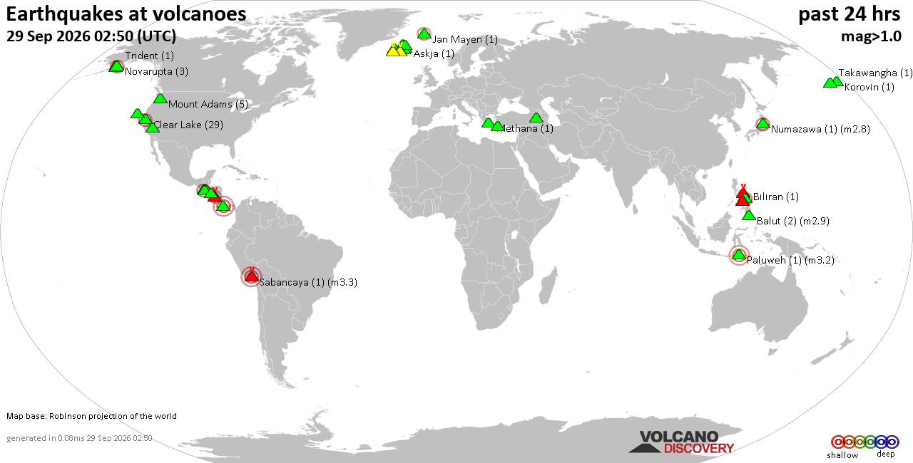
Volcano earthquake report for Tuesday, 29 September 2026
• M 0.6 - 67 km ENE of Pedro Bay, Alaska
• M 1.8 - 25 km SSW of Nanwalek, Alaska
• M 1.5 - 6 km NW of Pinnacles, CA
• M 2.0 - 58 km NE of King Cove, Alaska
• M -1.1 - 77 km NW of Ninilchik, Alaska
|

#835325
Wed 19 Aug 2026 09:53:PM
|
Joined: Feb 2001
Posts: 678,977
Launch Director
|
|
Launch Director
Joined: Feb 2001
Posts: 678,977 |
SPC MD 2040MD 2040 CONCERNING SEVERE POTENTIAL...WATCH UNLIKELY FOR PARTS OF EASTERN MISSISSIPPI INTO SOUTHERN ALABAMA 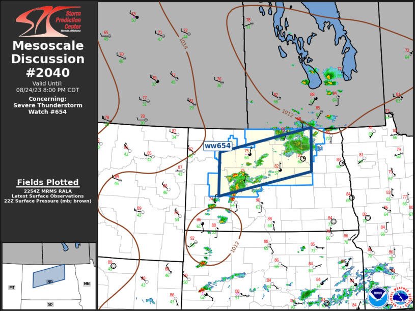
Mesoscale Discussion 2040
NWS Storm Prediction Center Norman OK
0229 PM CDT Wed Aug 19 2026

Areas affected...parts of eastern Mississippi into southern Alabama

Concerning...Severe potential...Watch unlikely

Valid 191929Z - 192200Z

Probability of Watch Issuance...20 percent

SUMMARY...Increasing thunderstorm development is likely through 5-7
PM CDT, accompanied by localized damaging downbursts and at least a
bit more widespread strong, but generally sub-severe, wind gusts.
Due to the disorganized and generally localized nature of the more
intense gusts, a severe weather watch is not currently anticipated,
but trends will be monitored.

DISCUSSION...Forcing for thunderstorm development remains unclear,
but perhaps aided by weak near-surface warm advection, initiation of
widely scattered thunderstorms appears underway within a broadly
confluent low-level regime across eastern Mississippi into southern
Alabama.  This is occurring in the presence of light (10 kt or less)
north-northwesterly deep-layer mean flow, but thermodynamic profiles
characterized by a strongly heated, seasonably high moisture content
boundary layer, with steep lower/mid-tropospheric lapse rates of
potential wet-bulb temperature.

Heavy precipitation loading, coupled with evaporative cooling, may
contribute to localized damaging downbursts in the initially more
widely scattered strongest storms.  Gradually,
colliding/intersecting outflow may contribute to increasing
thunderstorm development with continuing potential for strong
surface gusts into early evening.

..Kerr/Smith.. 08/19/2026

...Please see www.spc.noaa.gov for graphic product...

ATTN...WFO...TAE...BMX...MOB...MEG...JAN...

LAT...LON   33788926 33668742 31508581 30828680 31098831 32058932
            33008981 33788926

MOST PROBABLE PEAK WIND GUST...55-70 MPH
Read morehttps://www.spc.noaa.gov/products/md/md2040.html
|
|



CMS The Best Conveyancing solicitors conveyancing quotes throughout the UK
For any webhosting enquiries please email webmaster@aus-city.com
|
|
Forums60
Topics846,460
Posts881,255
Members2,960
| |
Most Online102,106
Jul 10th, 2026
|
|
|









































